Geoscience Reference
In-Depth Information
Upscaling - from pore to field, and beyond
...
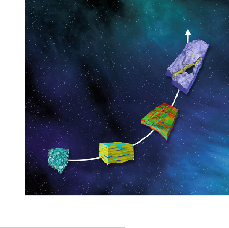
In multi-scale geological modelling, the
essence is that geological concepts are used to
make the transition from smaller-scale
measurements to larger-scale estimates (models)
of reservoir properties or behaviour (Fig.
4.1
).
Geological modelling in itself is an art form
requiring some intimate knowledge of the geo-
logical system - typically involving Picasso-type
geologists (Fig.
4.2
) with an interest in detail. For
upscaling we require representative geological
models in which the geological elements (e.g.
layers of sandstone, siltstone, mudstone and
limestone) are represented as properties relevant
for fluid modelling - porosity, permeability,
capillary pressure functions, etc.
This process inevitably involves some simpli-
fication of the intricate variability of rock archi-
tecture, as we aim to group the rock elements into
4.1
Multi-scale Flow Modelling
This chapter concerns the implementation of
multi-scale flow modelling for oil and gas reser-
voir studies.
Multi-scale flow modelling
is
defined here as any method which attempts to
explicitly represent the flow properties at more-
than-one scale within a reservoir. We may, for
example, have (a) an estimate of flow properties
around a single well in a specific flow unit (or
reservoir interval) and (b) a
rationale
for using
this estimate to calculate the flow properties in
the whole reservoir. This
rationale
could simply
be some multiplication factors transforming the
single-well flow property to the reservoir scale,
or might involve a 3-dimensional array (or grid)
of values drawn from statistical population
(which includes the single-well flow property).