Agriculture Reference
In-Depth Information
Grading plans follow a set of drawing conventions that have strong
similarity globally. If grading plans are drawn correctly following these
conventions, contractors, agency reviewers, and others will be able to
understand and see the designer's design intent, just as musicians and
conductors can hear what the composer heard and wrote down in the
form of a music score. One may, at first glance, recognize unique graphic
representation styles in grading plans prepared by different landscape
architects (see Figure 4.3). However, on a closer look, one will see that
recognizable graphic conventions were followed. People's handwriting
may look different, but the same conventions of composition and gram-
mar are closely followed.
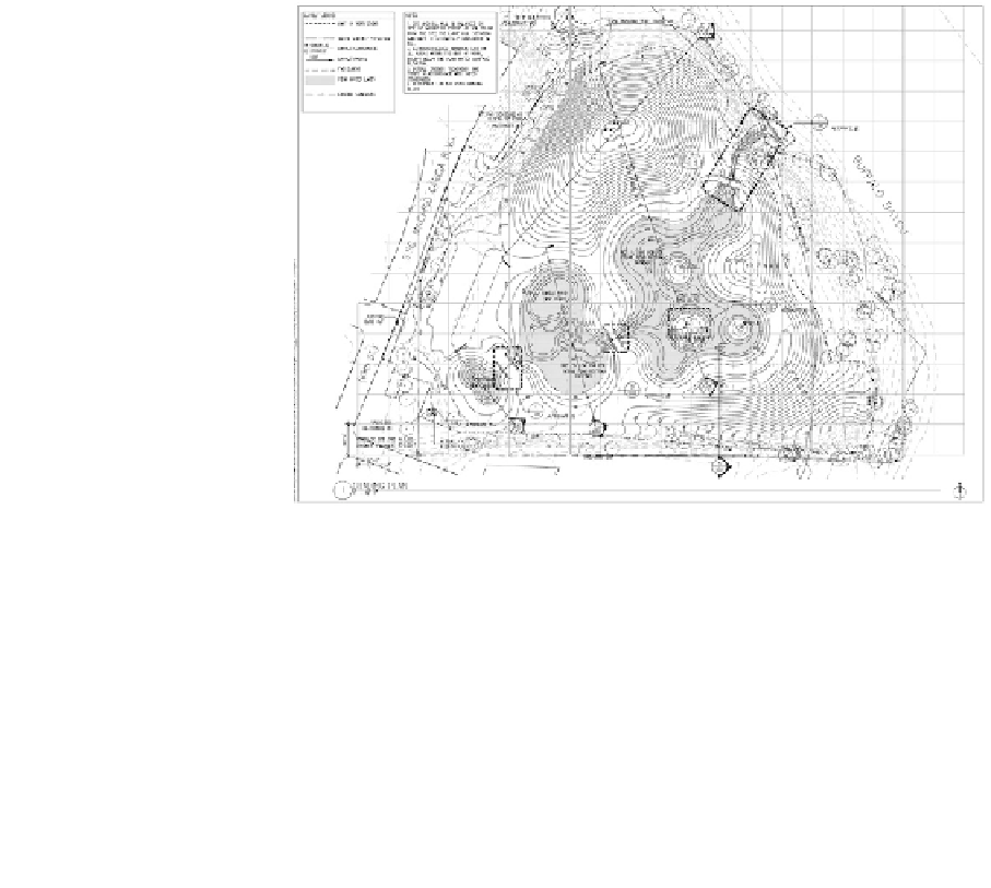
Figure 4.3
Landscape-Grading Plan: Buffalo Bayou Bend Park
Courtesy of sWA Group, houston, texAs
In order for the reader to understand the importance of having
and following graphic and documentation conventions, let's look at
Figure 4.4 and consider the following questions.
1.
What is the contour interval?
2.
What is the horizontal distance from point A to point B?
3.
What is the slope in percent between points C and D?