Agriculture Reference
In-Depth Information
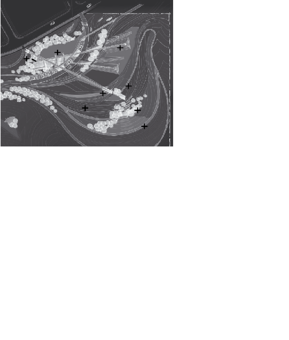
F
F
A
E
B
F
C
D
Figure 4.4
Design grading plan for Daybreak project
AdApted froM plAn Courtesy of desiGn Workshop, denVer, Co
4.
What is the elevation of point E?
5.
Where is the south side of the building?
6.
What are the elements labeled F in the image?
The answers to these questions will be more fully discussed in
subsequent chapters. However, the point to be made here is that the
drawing is very professional looking and seems quite clear in terms of
line work and attention to representing detail. But in fact the drawing
is nearly useless, if not totally so, for the purpose of answering our list
of six questions. To answer the questions, the drawing should have: (1)
contours labeled in terms of their elevation, (2) a scale, such as 1 inch
equals 40 feet, (3) a north arrow, (4) labels of key elements, and (5) a legend
that identifies the various symbols and line patterns.
Knowing the contour interval for a topographic map, the designer is
able to determine the degree of slope of different areas on a site and calcu-
late elevations. If a drawing has a legend, then the meaning or significance