Geography Reference
In-Depth Information
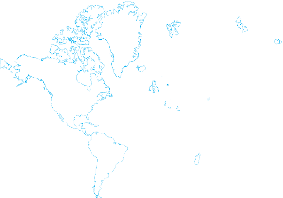
160°W
140°W
120°W
100°W
80°W
60°W
40°W
20°W
0°
20°E
40°E
60°E
80°E
100°E
120°E
140°E
160°E
80°N
60°N
40°N
20°N
0°
20°S
40°S
60°S
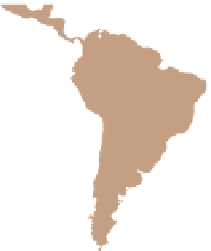
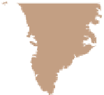
Figure A.4
Mercator's Projection
greatly exaggerates the size and shape of higher-latitude landmasses,
but direction is true everywhere on this map. In this Mercator map of the world, Africa and
Greenland look to be about the same size, but in reality, Africa is 14 times larger than Greenland.
various phenomena. The world map that forms the base for
these displays is one that is designed to give prominence to
land areas at the expense of the oceans. This is achieved by
“interrupting” the projection where loss of territory (in this
case water area) is not problematic.
When a map is planned, therefore, the choice of
projection is an important part of the process. An inap-
propriate selection may weaken the effectiveness of a map
and may lead to erroneous interpretations. Of course, the
problem diminishes when the area to be mapped is smaller
and the scale larger. We may consider various alternatives
when it comes to a map of all of North America, but a map
of a single State presents far fewer potential problems of
distortion. And for a city map—even of a large city such
as Chicago—the projection problem virtually disappears.
The old problem of how to represent the round Earth
on a fl at surface has been attacked for centuries, and there is
no single best solution. What has been learned in the pro-
cess, however, will be useful in fi elds of endeavor other than
Earthly geography. In the age of planetary exploration,
space probes send back images of the surfaces of the Moon,
Mars, Jupiter, and other components of our solar system,
and we will have to agree once again on grids, equators,
and prime meridians to map these bodies. What has been
learned in our efforts to map and represent the Earth will
be useful in depicting the universe beyond.