Environmental Engineering Reference
In-Depth Information
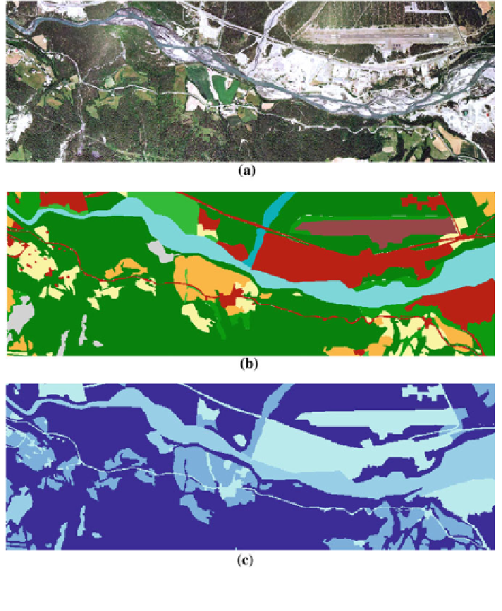
Fig. 6.16 The model procedure to create roughness map. a Available aerial photo. b Land use
map created and digitized in ArcGIS. c The roughness map in raster format
Search WWH ::

Custom Search