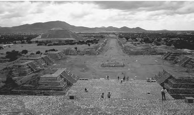
Teotihuacan was the first pre-industrial city in the New World. Rising to prominence in about 100 b.c.e., it subsequently reached massive proportions, supporting at its height (between about c.e. 350 and 650) a population of around 200,000 and covering some twenty square kilometers (eight square miles). This entire area was partitioned by a regular street grid into about two thousand rectangular “apartment compounds,” some containing groups of occupational specialists and others housing different social classes or ethnic groups. Most remarkable of all is the ceremonial center, its wide main street (the so-called Street of the Dead) lined with splendid courtyards, palaces, and temples. It also contained the two great pyramids that have subsequently become known as the Pyramid of the Sun and the Pyramid of the Moon.
Like many other Mesoamerican cities, the street grid is precise and oriented slightly askew from the cardinal directions. There are two different parts to the city, one around the Pyramid of the Sun, which deviates from the cardinal directions by about 15.5 degrees clockwise, and another farther to the south that deviates by about 16.5 degrees. Curiously, quite a large area in between seems to follow one north-south convention but the other an east-west one, resulting in street intersections, and even individual buildings, that have corners of around eighty-nine degrees and ninety-one degrees.
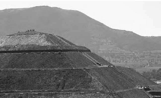
In all likelihood, one or two different sightings fixed the original alignments in each direction and were then propagated as more streets were constructed. But what was being sighted upon? One possibility is that the north-south direction reflects the orientation of the Pyramid of the Sun directly upon the hill Cerro Gordo to the north. Indeed, when viewed from the south, the pyramid does seem to “reference” the hill behind by mimicking its shape. Others have argued that the focus of interest was topographic features on the eastern horizon. But it may be misleading to consider the Teotihuacan street grid in isolation. Systematic studies of the orientations of the street grids of Mesoamerican cities show that deviations of between fifteen degrees and eighteen degrees clockwise from north-south-east-west are surprisingly common; indeed, they form a distinctive orientation group. This characteristic strongly implies that they were fixed using a common astronomical determinant.
The Temple of the Sun at Teotihuacan, Mexico, reflecting the shaping of the hill, Cerro Gordo, to the north.
Yet no overwhelmingly convincing possibilities emerge, especially among celestial objects rising to the east. A possible explanation of the east-west direction is that it aligned in the west with the horizon setting position of the Pleiades, but if so it is curious that the orientations of structures spanning many centuries remained on the same orientation, while the setting direction shifted owing to precession. Another possibility is that the direction corresponds to sunset on April 30 and August 13, dates significant because the longer interval between them is exactly 260 days, or the length of the sacred cycle that was a defining feature of all Mesoamerican calendars.
The Street of the Dead at Teotihuacan, Mexico, viewed from the Temple of the Moon at its northern end.


