Geoscience Reference
In-Depth Information
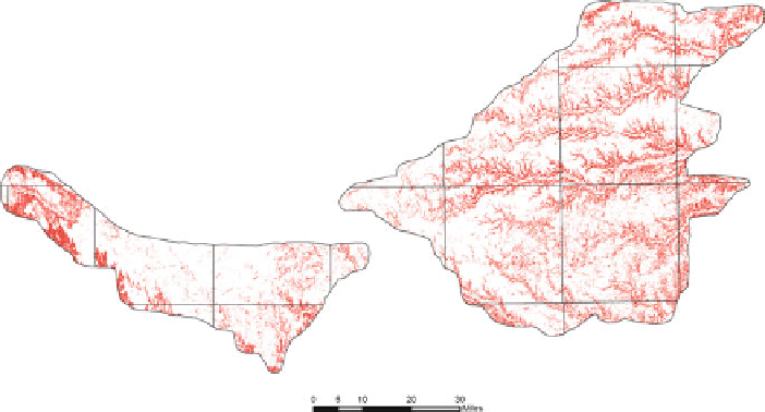
Fig. 7.2
The Revised Universal Soil Loss Equation (RUSLE) was used to estimate soil erosion in
the Rainwater Basin. Red areas are those with predicted soil loss greater than 5 tons/acre/year
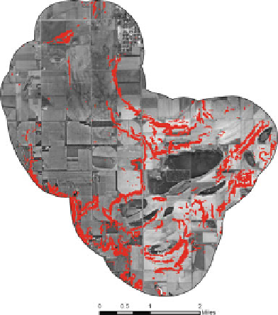
Fig. 7.3
RUSLE modeling
results were overlaid on
digital orthophotos to
facilitate assessment of
impacts on wetlands. This
example portrays the Massie
wetland basin (buffered to
1-km). Red areas are those
with predicted soil loss >5
tons/acre/year
Limitations of modeling were also noted by RWBJV staff. Although the RUSLE
model has been widely used and evaluated, the computed soil loss values are, nev-
ertheless, based on average precipitation conditions; consequently, years with above
or below-average precipitation will have different results. GIS technology, how-
ever, clearly provides opportunities to explore the utility of different models and
scenarios.