Geoscience Reference
In-Depth Information
In areas of few exposures two strategies are useful: (1) observe
the area from a high viewpoint, and mark the locations of
exposures on your fi eld maps - you can then plot a route to
visit all of them effi ciently; (2) check all the other small
exposures and clues (Table 3.2, p. 45).
10.5.4 Using other evidence
10
Topographic features: Feature mapping
In any area of poor exposure, gathering clues to the underlying
geology from the landscape is a useful skill. The topography
itself is heavily infl uenced by the bedrock underneath, so that,
for example, many breaks in slope mark the location of a
(a)
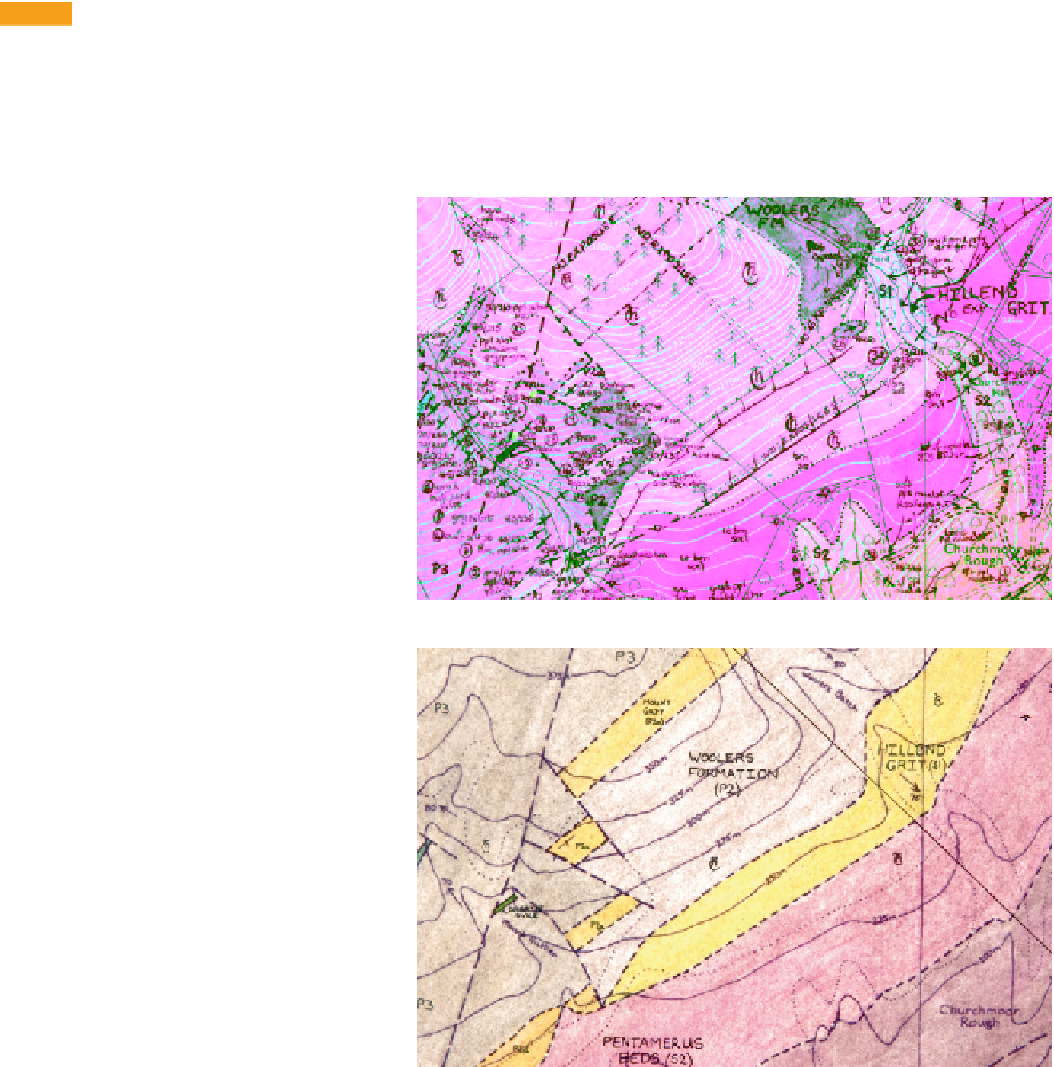
Figure 10.13
(a) Part of a fi eld
map of the Long Mynd area,
Shropshire, UK, incorporating
landscape features (e.g. breaks in
slope) as evidence of stratigraphic
boundaries. Each break in slope is
marked as a line with a series of
arrows pointing at it; two occur in
the centre of this extract, with
another at top right. Superfi cial
deposits that obscure the bedrock
geology are also mapped. (b) The
corresponding portion of the fi nal
fair copy map from the fi eld map
in (a), showing how the inferred
outcrop of the bedrock units is
depicted; the two central breaks in
slope mark the boundaries of the
Hillend Grit. (Field map and fi nal
fair copy map of Angela L. Coe,
Open University, UK.)
(b)