Geoscience Reference
In-Depth Information
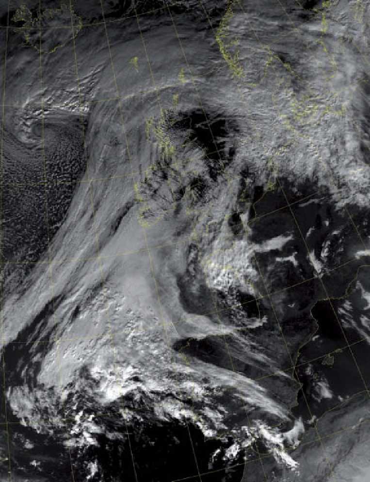
Plate 7.3
A mid-latitude cyclone is centred to the south of Iceland with the associated frontal cloud extending towards Britain
stratiform cloud being replaced by cellular convective cloud. The cold frontal cloud is not a single band, as several clear areas can
be seen within it. The conveyor belt cloud (see
Chapter 7)
is found between Iceland and Scotland, sweeping across the lower-
level cloud.
Image: Courtesy of the Satellite Receiving Station, University of Dundee, and NOAA
this position (see box, p. 145). However, farther away
from the depression, the intensity of uplift declines and
cloud may gradually thin as the front dies out. In this stage
of only weakly rising air the front is termed a
kata-front
and the transition zone of temperature is fairly broad
(
Figure 7.12
).
Rainfall is slight from kata-fronts, as the
clouds are not deep and the updraughts are weak.
In most depressions the air behind the cold front has
an anticyclonic trajectory. This allows the air to travel at
supergeostrophic speeds, pushing the cold front more