Geoscience Reference
In-Depth Information
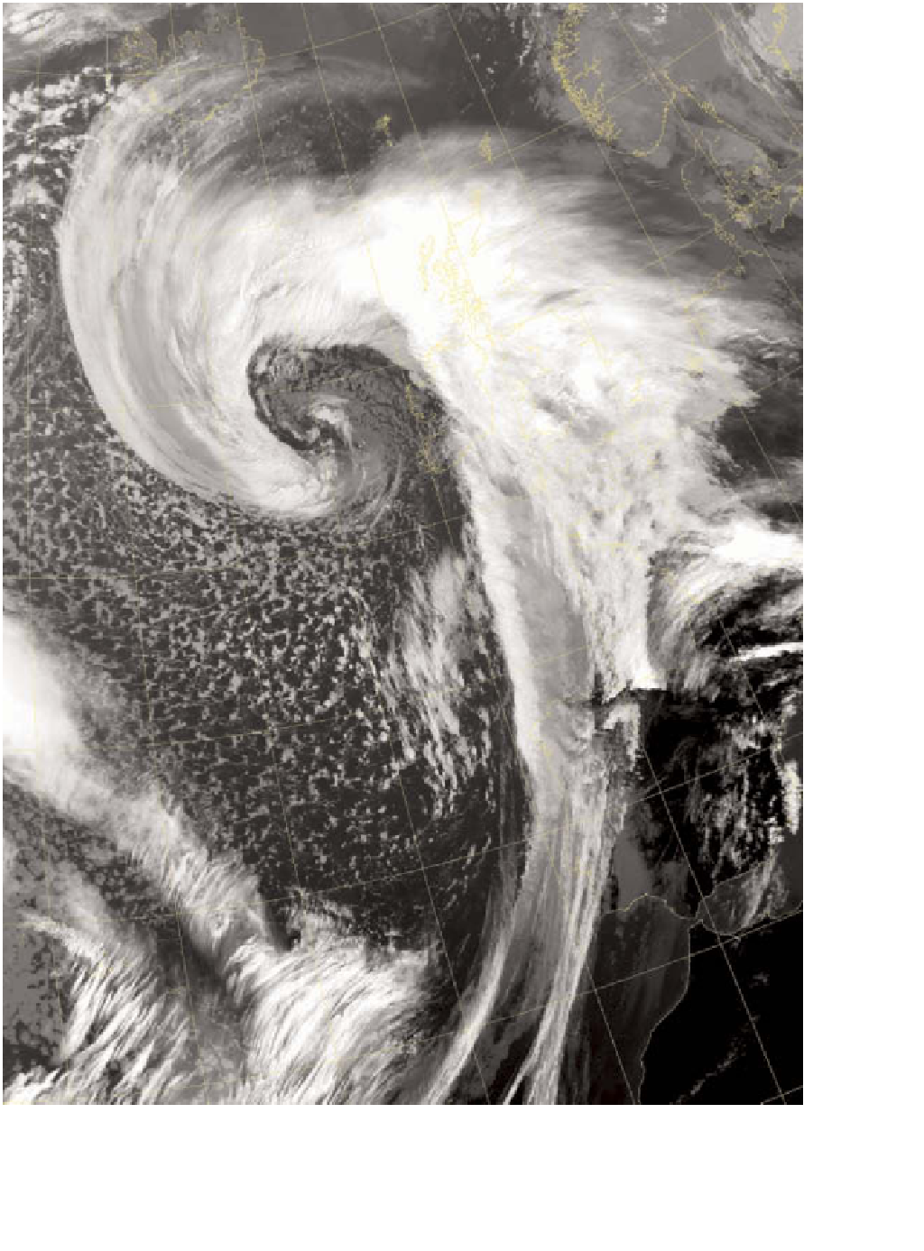
Plate 7.2
An example of the typical large spiral cloud pattern associated with the mid-latitude cyclone. The centre of the spiral
to the west of Scotland can be clearly seen. The higher, colder cloud stands out as lighter in tone. The cold front can be seen as
a narrow band whilst the high-level cirrus and cirrostratus cloud cover a large area of Scotland. This image is of the same date
and time as Figure 4.9 and can be used to compare the different information provided.
Image: Courtesy of the Satellite Receiving Station, University of Dundee, and NOAA