Geoscience Reference
In-Depth Information
0
100
200 km
TIBETAN PLATEAU
30
°
N
30
°
N
INDIA
75
°
E
80
°
E
85
°
E
90
°
E
95
°
E
MAIN BOUNDARY THRUST
DEFORMED TERTIARY SEDIMENTS
EARTHQUAKES WITH M 8
NORMAL FAULTS
GANGDESE GRANITES
GRANITE & GNEISS
UPLIFTS IN TETHYS HIMALAYA
NEOGENE TOURMALINE GRANITES
OPHIOLITES
MAIN CENTRAL THRUST
AND ASSOCIATED THRUSTS
>
∼
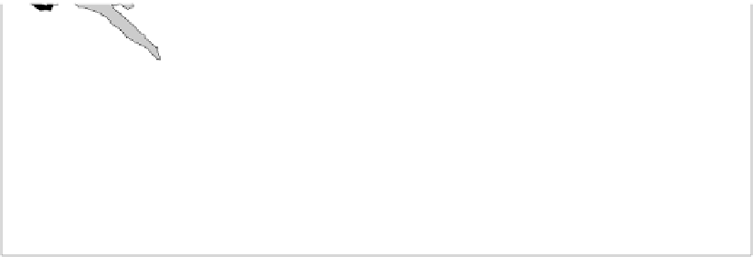
Figure 10.16.
(a) A tectonic map and earthquake fault-plane solutions for the
Himalayas. The southernmost thurst, the Main Boundary Thrust (MBT), is the
present location of the plate boundary between India and Eurasia. The string of
ophiolites delineates the Indus-Tsangpo suture (ITS), the original collision zone
between India and Eurasia. The rocks between the ITS and the Main Central Thrust
(MCT) were all part of the Indian (Tethyan) plate: first are the Tethyan passive-margin
sediments; south of these are the crystalline rocks of the Higher Himalaya which
were Tethyan crust. The rocks south of the MCT are very-thick, low-grade, clastic
Precambrian/Palaeozoic sediments that make up the Lesser Himalaya. The rocks
south of the MBT are Tertiary sediments of the sub-Himalaya foreland basin. The
black dots show the epicentres of the
M
8 earthquakes which occurred in 1905,
1934, 1897 and 1950 (from west to east), for which fault-plane solutions are not
available. (From Molnar and Chen (1983).)
≥
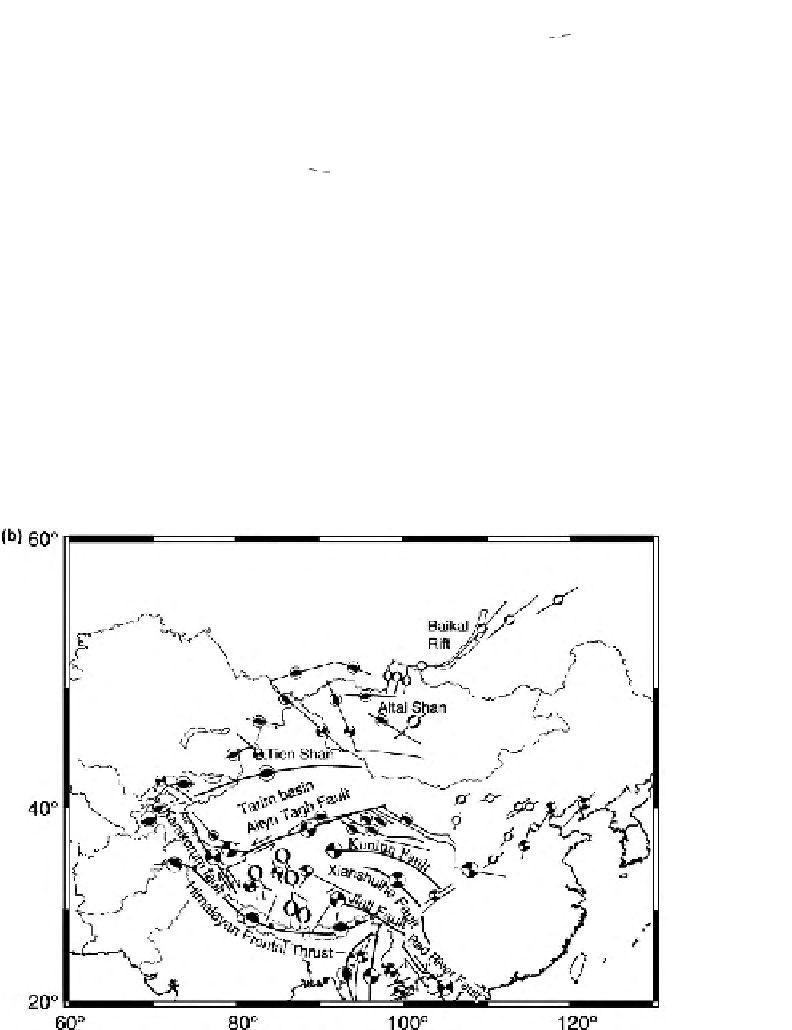
Figure 10.16.
(b) Main
faults and earthquake
focal mechanisms for
eastern Asia. Note the
normal faulting north of
the Himalayas in Tibet
and compressive faulting
in the Tien Shan north of
the Tarim Basin. (After
England and Molnar
(1997).)