Geoscience Reference
In-Depth Information
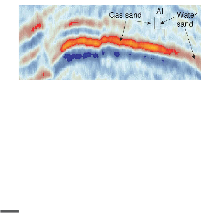
Fig. 4.3
Seismic section showing a tuned gas sand response.
Horizontal resolution of seismic data is also limited. Migration in theory collapses a
diffraction hyperbola to a focus whose width will be about half the dominant wavelength
(Claerbout,
1985)
if data are available at all dips, or more pessimistically a width
about equal to the dominant wavelength (Stolt & Benson,
1986)
if the dips that can
be incorporated into the migration are limited to a maximum of 30-45
◦
. This means
that the best lateral resolution we could hope for, with the 6-60 Hz wavelet, might
be about 60 ft, or about 18 m. However, horizontal resolution is severely degraded by
in migration velocity can degrade horizontal resolution by a factor of more than 5. In
practice, therefore, horizontal resolution will often be in the range 50-100 m. This is
something that should be borne in mind when making decisions on exactly where on a
seismic survey a well should be located. If it is very close to a major fault there will be
a risk of reaching the target on the wrong side of the fault. The horizontal resolution
also limits the geological detail that we can hope to see on seismic sections, though it
Seismic stratigraphy
4.2
To understand the distribution of a reservoir sand in the subsurface, we need to see it as
part of a depositional system. There are eight primary clastic (sand and mud) deposi-
aeolian and lacustrine. Over time, the depositional systems within a basin change; aban-
doned systems are buried and eventually may become reservoir rocks. Using a combina-
tion of seismic data and well control, it may be possible to understand the depositional
system well enough to be able to predict sand distribution and quality in areas that have
not yet been drilled. This is achieved in part by recognition of individual depositional
units from the seismic data, and in part by placing them within an overall context. The