Geoscience Reference
In-Depth Information
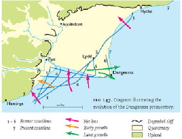
FIG
147.
Diagram illustrating the evolution of the Dungeness promontory.
FIG
148.
Looking southeastwards down the River Rother, with Rye in the foreground.
The gravel beaches of the present coastline of Rye Bay extend further to the left into
Dungeness. (Copyright Dae Sasitorn & Adrian Warren/www.lastrefuge.co.uk)
Inland from the shingle-covered areas are large areas of flat-lying, open, ag-
ricultural land with distinctive dykes and marshes. Although there are many local
names, these flat-lying areas are often grouped under the general name of the Romney
Marshes.


