Geoscience Reference
In-Depth Information
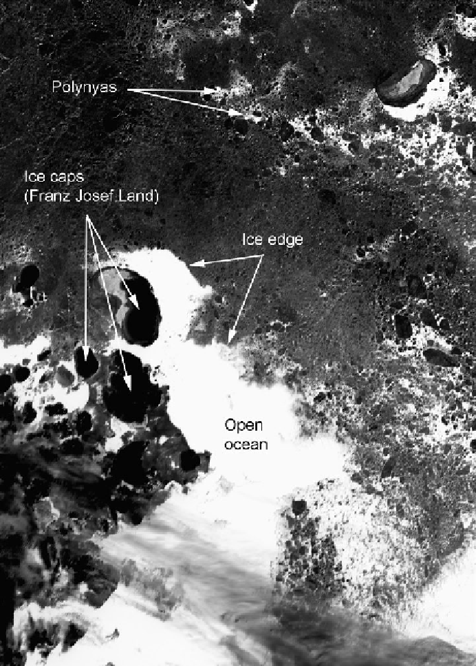
Figure 2.6.
Sea ice field in the Barents Sea near Franz Josef Land (see
Figure 2.3
) for
July 6, 2001, based on visible-band Moderate Resolution Imaging Spectroradiometer
(MODIS) imagery. The horizontal resolution is about 250 m. The image is about 526
km by 376 km. The scene shows the transition from high ice concentration to open
ocean waters (the marginal ice zone). Note the large individual ice floes and polynyas
on the right-hand side of the image and the ice caps on the islands of Franz Josef Land
(courtesy of T. Haran, NSIDC, Boulder, CO).