Geoscience Reference
In-Depth Information
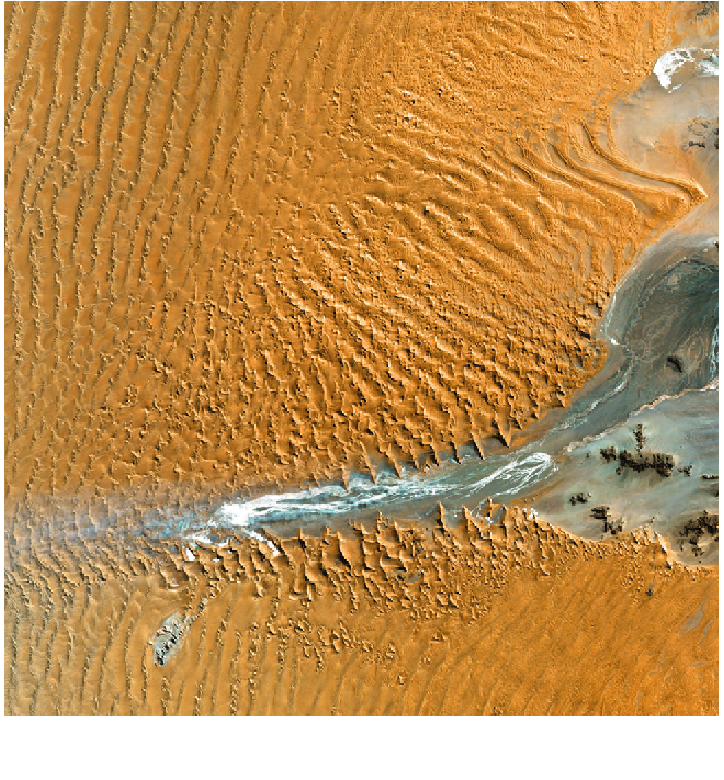
Fig. 18.6
Landsat 7 image of part of the Namib sand sea acquired in
2000, showing a staggering diversity of dune forms, and the interaction
of the sand sea with the ephemeral Tschaub river. Image provided by
the USGS EROS Data Center Satellite Systems Branch as part of their
Earth as Art series
significant global surveys of sand dunes on Earth, the for-
midable Global Sand Seas publication by the US Geologi-
cal Survey, edited by McKee (1979a). Considerable effort
has been made in maintaining a continuous capability and in
robustly archiving the data, permitting long-term studies of
changes in land use and geomorphology (notably, tracking
dune movement) and these data, once accessible only by a
few, can be readily obtained for free by anyone on the
internet.
Outside the USA, a major player in remote sensing was
the French SPOT program, whose first satellite was laun-
ched in 1986. It too provided imaging of 10-20 m resolu-
tion in a range of wavebands. Since most commercial
remote sensing is geared towards characterizing vegetation,
the data are often presented in a somewhat false color (a key
giveaway in an image being when vegetated areas look
'red', as healthy plants reflect strongly in the near-infrared).
In such situations, the evaporite pans on which many dunes
Search WWH ::

Custom Search