Geoscience Reference
In-Depth Information
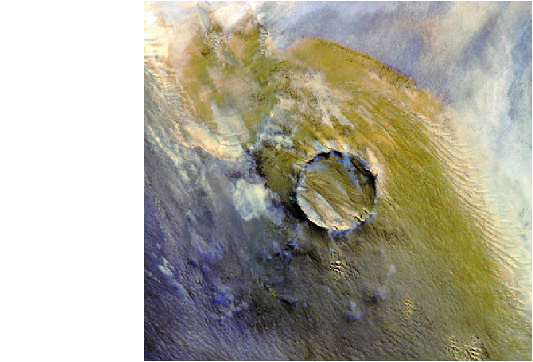
Fig. 18.5
The 2.5 km-diameter
Roter Kamm impact crater in
Namibia is seen here in this
ASTER image of the Namibian
sand sea. Compound linear dunes
are seen to cross the crater floor,
much as seen at Titan (Fig.
13.10
). Image NASA/GSFC/METI/
ERSDAC/JAROS, and U.S./
Japan ASTER Science Team
imaged the far side of the moon. Within another 3 years,
Mariner 4 would be the first spacecraft to fly by Mars, and
the first Ranger close-ups of the Moon would take place.
An early documented report is of dunes in north-west
Africa, recorded by automatic cameras on an unmanned test
flight (MA-4) of the Mercury series (Morrison and Chown
1964); doubtless there may be similar reports in the Soviet
literature. The first high-quality pictures of dunes from
space were, however, taken by hand. While the first manned
missions concentrated on learning how to function in orbit,
as mission durations increased it became possible to con-
template making scientific observations. The Gemini 4
mission in June 1965, generally more famous for Ed
White's spacewalk—America's first—lasted a record
4 days, and featured a dedicated experiment to perform
high-quality scientific imaging of the Earth using a Has-
selblad film camera. Among the features captured and
documented (Lowman et al. 1967) were large linear dunes
in Egypt (see Fig.
18.4
; see also the section on fictional
dune worlds).
Unlike manned missions (usually launched into more
energetically-favourable orbits), systematic imaging of the
Earth's surface is usually performed from satellites in near-
polar orbits such that they can observe the entire surface of
the Earth. These orbits are usually tuned to be sun-synchro-
nous, such that they observe sites at the same time of day,
which facilitates change detection. Generally, the time of day
chosen is close to noon, when shadows are minimized.
The first dunes on another world were seen by Mariner 9
at Mars in 1972. Although modest in quality and resolution
(*100 m) by modern standards, these first images are still
being used as a basis for comparison to detect dune changes.
Mars has been imaged progressively better by the armada of
spacecraft sent there since, with the spatial resolution
improving by about an order of magnitude each quarter-
century (through *1.5 m on Mars Global Surveyor in
1997, and to the *0.5 m on Mars Reconnaissance Orbiter
in 2006).
Similar improvement had been seen at Earth only a
decade or so earlier than at Mars. Remote sensing for
geological/geomorphological applications really took a step
forward with the US Landsat program (e.g., Fig.
18.7
).
Since 1972, this has provided various imaging data as
technology has improved but, most significantly, allowed
study of sites worldwide with resolutions of *20 m. The
availability of that dataset made possible one of the most
Search WWH ::

Custom Search