Geoscience Reference
In-Depth Information
Susquehanna
River
Delaware
Bay
Potomac
River
Chesapeake
Bay
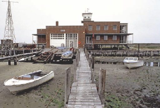
Figure 19.6 Tidal fluctuations in Chesapeake Bay.
This image
shows a boat dock at low tide. At high tide, the water reaches ap-
proximately halfway up the support beams of the dock (white arrow).
James
River
Atlantic
Ocean
for about 56% of the daily tides, whereas about 44% is related to
the Sun's effect. Other factors influencing the nature and timing
of tides are related to the geometric relationship of Earth to the
Moon and Sun and how it varies on a daily and monthly basis.
The simplest tide to explain is the one created on the side
of Earth that faces the Moon. Think of this tide as a bulge of
water that forms when ocean water is drawn up and along by
gravity as the Moon passes over. A similar bulge also forms
on the opposite side of Earth, however, which may seem odd
because this side of the planet faces away from the Moon. How
can this tide form? Tidal bulges appear on both sides of
Earth because of the combined effects of the Moon's
gravitational pull
and
the fact that the Earth and
Moon rotate around each other on a common axis.
Examine Figure 19.7 to see how these relation-
ships work. If the Earth and Moon did not rotate
around each other, they would fly through space
side by side and the tidal bulge would always be
on the side of Earth facing the Moon. Because they
rotate around a common axis, however, a centrifu-
gal force exists that is equal to the gravitational forces
between the two objects. As a result, the Earth and Moon
are always the same distance apart and each particle of Earth
experiences both forces. A tidal bulge forms on the side of Earth
most directly facing the Moon because the Moon's gravitational
pull there is slightly greater than the centrifugal force toward
the other side of Earth (Figure 19.7a). The high tide associated
with this gravitational force is called a
direct tide
. A tidal bulge
also forms on the other side of Earth because the centrifugal
force (of the rotating bodies) on this side of the planet is slightly
greater than the gravitational pull of the Moon (Figure 19.7b).
The high tide associated with this centrifugal force is called an
indirect tide
. Each of these tides has a corresponding low tide.
To fully understand the timing of the direct and indirect
tides at any given point, you must first consider the daily (24-h)
rotation of Earth on its axis. If the Moon were stationary rela-
tive to Earth, any coastal location on the planet would rotate
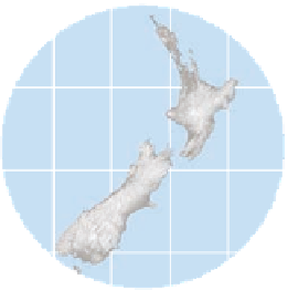
(a)
170° E
174° E
178° E
166° E
Tasman Sea
38° S
Queen
Charlotte
Sound
Wellington
42° S
Pacific
Ocean
46° S
(b)
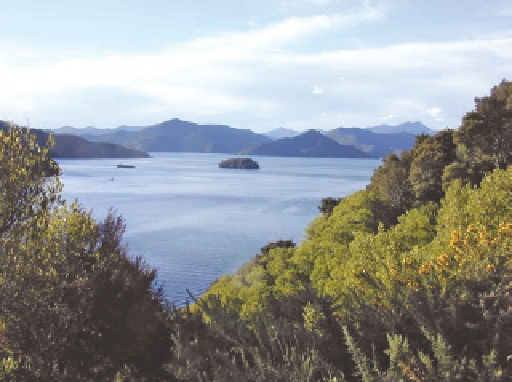
Figure 19.5 Flooded valleys on the continental margin.
(a) Chesapeake Bay is really a large river valley, created by join-
ing rivers, including the Susquehanna, Potomac, and James. The
valley was later flooded by postglacial rising sea levels. Delaware
Bay, shown in the upper right of the image, is also a ria that was
created when a portion of the ancestral Delaware River valley was
flooded because of eustatic change. (b) Queen Charlotte Sound,
New Zealand, evolved when rising sea levels flooded this valley
on the northern tip of New Zealand's south island.
is approximately 149,000,000 km (93,000,000 mi). In contrast,
the Moon is only about 386,000 km (240,000 mi) away from
Earth. As a result, the Moon's gravitational pull is responsible