Geoscience Reference
In-Depth Information
As discussed in Chapter 9, however, reconstruction of
oxygen-isotope records derived from glaciers and ocean
sediments indicates that more than 20 such glacial periods
occurred during the Pleistocene Epoch. These numerous
cycles are apparently related to Earth's orbital fluctuations
associated with the Milankovitch theory, which was also
discussed in Chapter 9. Recall that this theory describes
how Earth's geometric relationship with
the Sun slowly fluctuates over time, with
changes in axial tilt, precession of the
equinoxes, and orbital shape at distinct
cyclic intervals. In this context, the most
intense glaciations would be theoretically
associated with periods when (1) Earth
was farthest away from the Sun in summer,
(2) axial tilt is less than present, and (3)
equinox occurred during the summer and
winter months. As these geometric condi-
tions slowly aligned over tens of thousands
of years, the amount of solar radiation
striking the high latitudes of the Northern
Hemisphere in summer would gradually
decrease, resulting in progressively cooler
summer temperatures and the growth of ice
sheets. Because of these new understand-
ings, the only names maintained from the
traditional glacial model in North America
are the Illinoisan and Wisconsin advances
because the deposits associated with these
most recent glaciations are easily recog-
nizable. All other glaciations are lumped
into one category called
Pre-Illinoisan
.
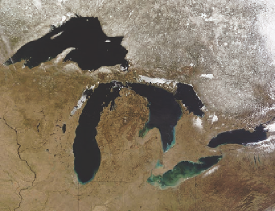
Although the most recent deglaciation of the Great Lakes
region left a multitude of glacial landforms, including moraines
(such as Figure 17.22b), kames, eskers, outwash plains, and
drumlins, the most prominent landscape feature is the Great
Lakes themselves (Figure 17.29b). The evolution of these lakes
is fascinating and is a testament to the power of glacial ice and
how rocks of different resistance can influence the shape of a
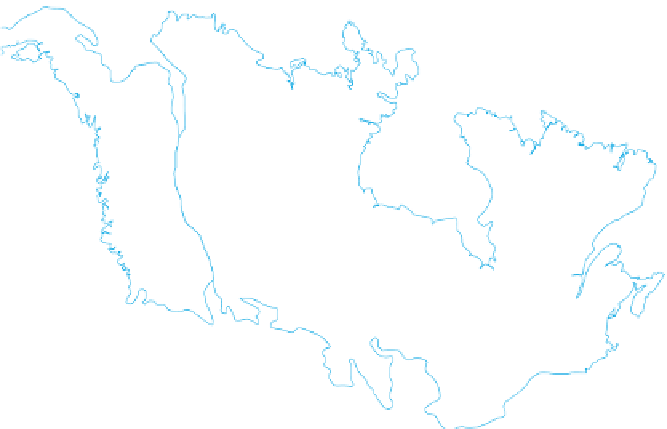
Arctic
Ocean
Baffin
Bay
Hudson
Bay
Laurentide Ice Sheet
Pacific
Ocean
Atlantic
Ocean
(a)
Lake
Superior
snow
The Wisconsin Glaciation
and Evolution of the Great Lakes
Given that the Wisconsin glacial advance is the most recent,
it is easily the most studied of all Pleistocene glaciations be-
cause its effects can still be seen clearly at the surface. Although
strong evidence for this glaciation is found in northern Europe
and western Canada, a great place to examine its impact on the
landscape is the Great Lakes region of North America. Follow-
ing the post-Illinoisan interglacial period, the Laurentide Ice
Sheet began to expand again about 110,000 years ago. For the
next approximately 90,000 years ice advanced south, reaching
its most southerly position in central Ohio, Indiana, and Illinois
by about 20,000 years ago. At this time,
all
of what is now
known as the Great Lakes and the state of Michigan were buried
beneath a sheet of ice (Figure 17.29a) that was probably hun-
dreds of meters thick. This ice subsequently melted from the
Great Lakes region between about 16,000 and 10,000 years ago
and was part of the overall collapse of the Laurentide Ice Sheet
at this time. The glacier melted in large part because Earth's
axial tilt had increased to the point that sufficiently more so-
lar radiation was received at high latitudes in summer to cause
rapid melting.
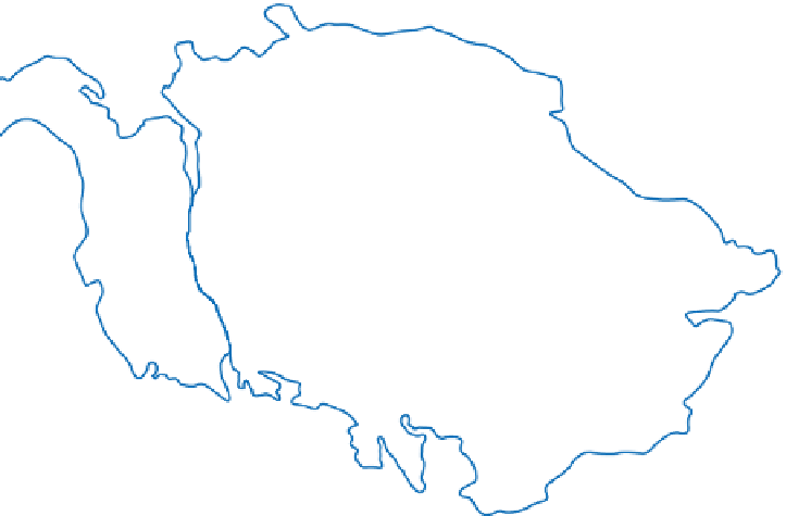
frozen water
Georgian
Bay
Lake
Huron
Lake
Michigan
Lake
Ontario
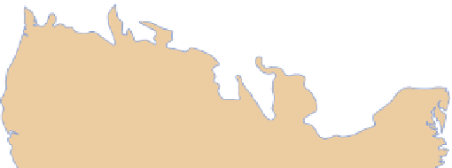
Lake Erie
(b)
Figure 17.29 Extent and impact of the Wisconsin glacia-
tion.
(a) During the most recent ice age, the Laurentide Ice Sheet
and Cordilleran Ice Sheet collectively covered most of northern
North America. (b) Satellite image of the Great Lakes acquired in
April 2005. These lakes were formed when the advancing ice fur-
ther enlarged and deepened preexisting glacial troughs that had
been scoured out of relatively soft rocks. Note the extent of snow
cover, frozen lakes, and the suspended sediment in Lake Erie.