Geoscience Reference
In-Depth Information
Well
Original
water table
Recharge by
infiltration
Cone of
depression
Water drawn
into well
(a)
Year-round
deep well
Unsaturated
zone
Wet-season well
(dry during dry season)
Saturated zone
(wet season only)
Saturated zone
(year round)
Water table
during wet season
Water table
during dry season
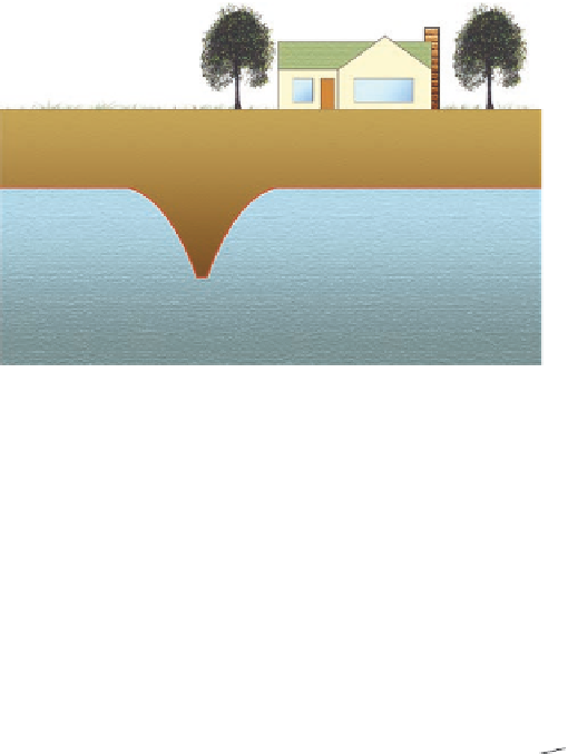
Figure 15.7 Groundwater de-
pletion.
(a) When water is drawn
from an aquifer, the water table
is depressed in a conical shape.
(b) Deep wells draw water from
zones that are saturated year
round, draining far more water
than shallower, seasonal wells.
Large cone of
depression, large
drop in water table
Small cone of
depression, small
drop in water table
(b)
Kansas and the Texas Panhandle, for example, the average drop
in the level of the water table was more than 12 m (40 ft) between
1980 and 1996 (Figure 15.8a). This rapid decline has occurred in
these regions because the withdrawal rate is as much as 22 times
greater than the recharge rate, which averages only 0.5 cm/year
(0.2 in./year). Signs of this drop in the water table can be seen
throughout the region. For example, many of the streams have
dried up (Figure 15.8b) because the water table is now below the
base of the channel.
As a result of the heavy reliance on groundwater mining,
the High Plains Aquifer may disappear in many places by
the middle of the 21st century. Estimates suggest it will be
entirely depleted over a broad area by 2300. This appraisal
is based on the amount of groundwater extracted from the
aquifer compared to its recharge rate due to infiltration of
precipitation. Estimates are similar for the depletion of other
aquifers around the world. In the Sahara Desert, for example,
scientists suggest that aquifers there may last 50 years. Put
another way, natural resources that took hundreds of thou-
sands of years to evolve will disappear essentially within a
timeframe of 200 years (from the mid-1800s to 2050) due to
human impact.
In spite of these trends the spatial extent of irrigated land
continuous to expand across the region. This expansion is be-
ing driven by a complex interaction of several things, includ-
ing climate change, population growth, production of biofuels,
and other factors. Efforts to regulate and manage the system
have shown mixed results due to numerous political, cultural,
and economic variables. Some farmers recognize the need for
conservation and are shifting to dryland agriculture, which is a
crop-rotation system designed to conserve soil moisture by leav-
ing fields fallow (or crop-free) every other year. Other farmers


