Geoscience Reference
In-Depth Information
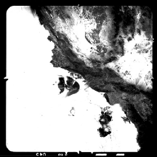
FIGURE 19.4
CORONA Argon KH-5 image of the Santa Barbara channel. Approximately 1965. (Author.)
linear feet of film taking up 39,000 storage canisters (Figure 19.4). Three aspects of CORONA
are critical to the argument here. First, the amount of film and repeat imaging led to the need
for an automated system to locate and recover images on demand, what would today be called
a digital library. Second, the peculiar geometry of the panoramic camera required systems for
automatically geo-registering and re-projecting images into map geometry for display and overlay.
This was initially done in analogue, but later digitally via camera models, creating the first
military
GIS
(Cloud, 2002). Third, once CORONA became less mission critical to the Cold War as new sys-
tems came on-line, it began to be used for civilian mapping purposes, first for environmental crises
by the Environmental Protection Agency (EPA) and later for routine map revision by the USGS
(Figure 19.5). The USGS created several special mapping centres for this purpose, and by 1968,
'the Geological Survey became the largest civil agency user of the C
ORONA
imagery' (Baclawski,
1997). This clandestine cooperation was revealed in 1995, when CORONA imagery and the pro-
gram were declassified (Ruffner, 1995; Peebles, 1997). Thus, CORONA's history is another good
example of how geographical problem-solving, cartography, applied mathematics and computer
science came together not only to work toward national security but to also invent new technologies
and create new disciplines, among them GC.
19.4 EVOLUTION OF COMPUTER CARTOGRAPHY
As the Cold War gave way to the New World Order, GIS entered the mainstream and geo-position-
ing entered everyday life through navigation and location-finding systems. By way of making some
general observations, consumer products as commodities often seem to have a broader basis in basic
scientific research, with a time lag determined by the degree of sensitivity of the science. These
science efforts are often coordinated nationally or globally and are led by funding efforts spear-
headed by national science institutions or the Department of Defense. The larger institutions that
deal with geography, the Census Bureau, the defence and intelligence agencies, the civilian map-
ping agencies, NASA, the EPA, etc., are all fully invested in the integration of cartography/GISci