Geoscience Reference
In-Depth Information
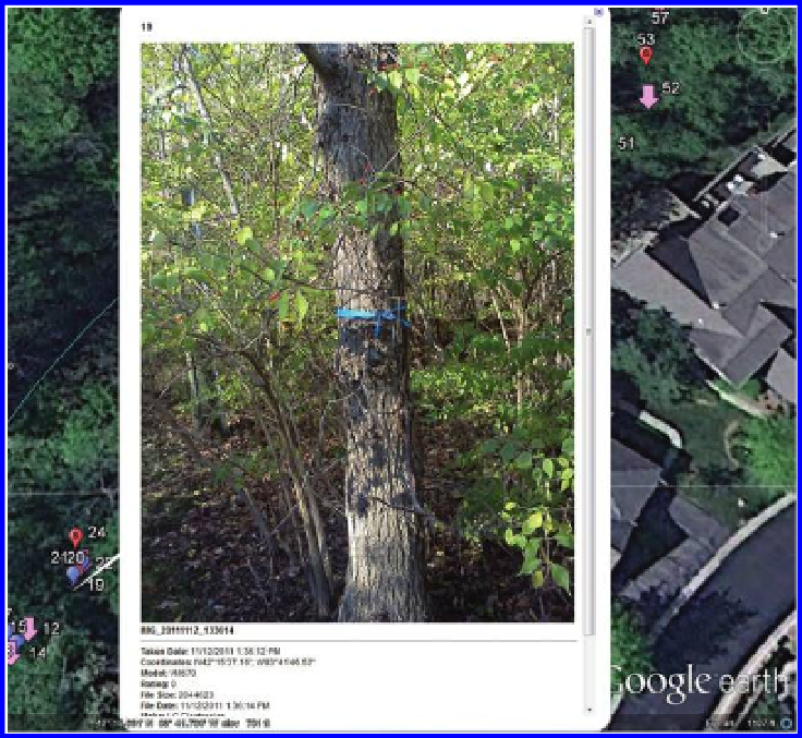
Figure 4.12 Blue tagged tree. Source of base map and data: Google Earth mapping
service © 2012 Google and Image US Dept of State Geographer, © 2012 Google,
Data SIO NOAA US Navy NGA GEBCO, ©2012 MapLink/TeleAtlas.
One way to improve accuracy, directly in Google Earth, is to type in the
coordinates (take care to make sure they are in a numerical format suited
to the settings in Google Earth) in the “Fly to” slot under the “Search”
arrow in the upper left-hand corner. Then press the magnifying glass but-
ton. The globe image will move to become centered on the coordinates
typed in. Now, without moving the image, pull down the “Add” menu and
choose “Placemark.” The default setting is to locate the placemark in the
center of the image so now the numbers typed in will match accurately with
the placemark location. This strategy is both quicker and better than the
one above. Still, though, there is no guarantee that the coordinates typed
in are the best available coordinates. The camera may have stored them
to more decimal places than we know about and so there may be error
due to round off or truncation. As we have seen earlier, shaving off even a
single number can cause difficulties in local studies. Now you should have
greater appreciation for why we used extra software (GeoSetter, in this
case) to ensure accurate registration of camera coordinates with Google
Earth coordinates!
Search WWH ::

Custom Search