Geoscience Reference
In-Depth Information
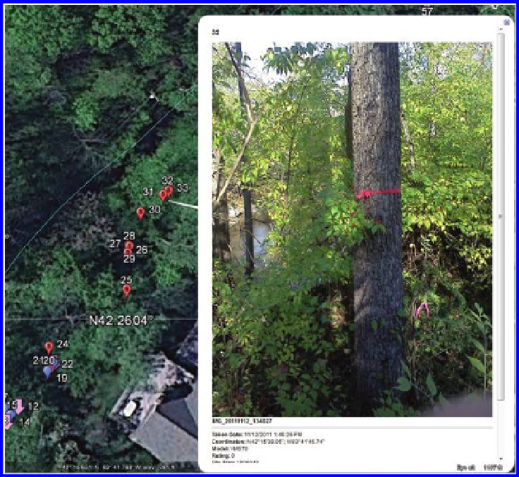
Figure 4.11 Photo mounted in Google Earth. Note that the photo has a pointer on it
that points to the correct balloon location. Source of base map and data: Google
Earth mapping service © 2012 Google and Image US Dept of State Geographer, ©
2012 Google, Data SIO NOAA US Navy NGA GEBCO, ©2012 MapLink/TeleAtlas.
on the project to ensure agreement. Neighborhood involvement and monitor-
ing was critical in developing a constructive relationship among the various
parties adjacent to this project.
Next, try your hand at simple insertion of a balloon and an image directly
into Google Earth. A County GIS file of streams overlain on Google Earth
would show the creek from above as it passed through the dense woods.
Load the free Google Earth on your computer or alternatively, use the Google
Earth 3D “Earth Viewer” plug-in to your web browser. Zoom in to this area
near N 42.2604 and W 83.6964. In Google Earth, pull down the “Add” pull-
down menu (
Figure 4.13
). Choose “Placemark.” Slide the placemark around
and try to position it at N 42° 15
′
38.05
″
, W 83° 41
′
45.74
″
, the position of the
tree in
Figure 4.12
. How confident are you that you can get the placemark
in exactly the spot that was geotagged by the camera? How would you like
to try this process for 81 different points? How confident would you be in
the results? It is difficult, by hand, to position the mouse cursor at a precise
latitude-longitude coordinate for one point, much less for numerous points.
Search WWH ::

Custom Search