Geoscience Reference
In-Depth Information
Day5—Sunday,May15
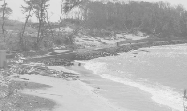
Figure A.10 Oya Beach in Motoyoshi, with various types of concrete armor
units for shore protection
(Source: Brian N. Jones)
Today was another long day of driving and site investigations. We had about a two-
hour drive to get from our hotel to the coast, and then several inland detours once we
were at the coast due to bridge losses or road closures. Despite the travel difficulties,
we were able to visit or look at Oya Beach in Motoyoshi, Koizumi Beach,
Minamisanriku, Shizugawa Bridge, Okawa, Utatsu, Onagawa and Ishinomaki, and
each provided us with both more understanding of the tsunami and more thoughts and
questions about the event. Fortunately for us, researchers from the Ports and Airports
Research Institute (PARI), the Japan Society of Civil Engineers and others already
had completed surveys of these sites, so we have information on the inundation zone,
inundation and runup that can help our examination.
Oya Beach was one of the many small pocket beaches along the coast in Motoyoshi
and was our first open coastal site. There were a variety of shore protection structures
along the beach that offered some opportunity to observe the performances of each
structure under relatively similar tsunami conditions. At the center of the cove there
was a relatively low-profile (five meters in height) pre-fabricated terraced revetment
constructed of flat concrete slabs, designed to provide easy walking access to the
beach and dissipate wave energy and run-up. Unfortunately, this area was
overwhelmed by a 17-meter-high inundation from the incoming tsunami. Despite the
lack of significant slab overlap or anchoring, the low-profile revetment structure was
in good condition, while 30 meters inland, a train bed had been completely destroyed.
Not far from the terraced revetment, we observed a vertical seawall fronted by
tetrapods and then by more cubical concrete armor units that the Japanese call
Search WWH ::

Custom Search