Geoscience Reference
In-Depth Information
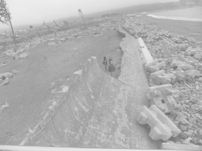
flow depth behind the wall. Many of the concrete armor units that were placed in
front of the older seawall were scattered and broken on the landward side of the
seawall with severe damage done to the seawall. Even a section of the newly
constructed seawall had severe damage to its upper re-curved face and was
completely broken off and missing. The entire concrete lined back slope of the new
seawall was ripped away and showing substantial scour from heavy overtopping and
return flow on the wall's inland side.
Figure A.2 Noda Seawall, new section in foreground, upper portion of the older
section has been destroyed. Pine trees inland of the wall have had their branches
stripped from the lower 10-meters — an indicator of flow height at this location.
(
Source: Ron Noble)
Kuji Fishing Port, north of Noda, had an inner breakwater consisting of about 20-ton
tetrapods protecting to the ocean side slope of its concrete caisson breakwater. This
inner breakwater sustained minimum damage although some of the tetrapod units had
been dislodged and transported to the top of the caissons. At the inner fishing port's
wharf, there was damage to the pile supported concrete deck when it was lifted up
over adjacent concrete deck that covered a bulkhead protected landfill. A tsunami
seawall with an aluminum gate bordered the landward side of the fishing port. The
large gate had been damaged and shifted from the landside towards the harbor side;
there was also buckling of the driveway area between the tsunami wall and port's
waterside wharfs.
Search WWH ::

Custom Search