Geoscience Reference
In-Depth Information
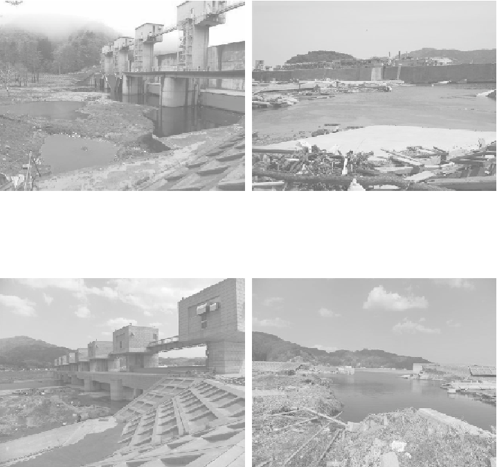
Figure 51. Fudai River water control
structure — Roadway damage and
scouring on inland side due to tsunami
overtopping of structure and resultant
supercritical landward side flows
Figure 52. Shizagawa fishing port —
Severe scouring indicative of tsunami
overtopping of seawall resulting in
supercritical flows on the port's inland
side
Figure 53. Kamehama water control
structure —Damage and scouring on
inland side due to tsunami overtopping
of structure and resultant supercritical
landward side flows
Figure 54. Otsuchi tsunami wall —
Severe scouring indicative of tsunami
overtopping of tsunami wall appears
resulting in supercritical flows on
Otsuchi's inland side
3.8
Scour
The removal of earthen sediments and vegetation (sands, silty sands, and other top
soils) by the incoming tsunami wave up-rush (runup) and subsequent seaward
draining of the floodwaters (drawdown) generated abnormally high stream-flow
velocities (currents) and turbulence (Figure 55). When hydrodynamic flow conditions
exceed soil threshold conditions, soil erodes quickly. Erosion occurs often at the
inland base or toe of structures when overtopped by tsunami inundation (Figures 56 -
59 and Figures 65 and 66). Figures 60 - 62 show schematic diagrams of the measured
scour patterns. Scour was especially prevalent at structural corners and areas of flow
convergence, as seen in Figures 63 and 64.


Search WWH ::

Custom Search