Geoscience Reference
In-Depth Information
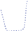
Fig. 8.3
Water-level curve for the Pärnu area. Water-level elevations of all sites were corrected
low water level, discussed in detail in the text, according to Uku and Reiu sites
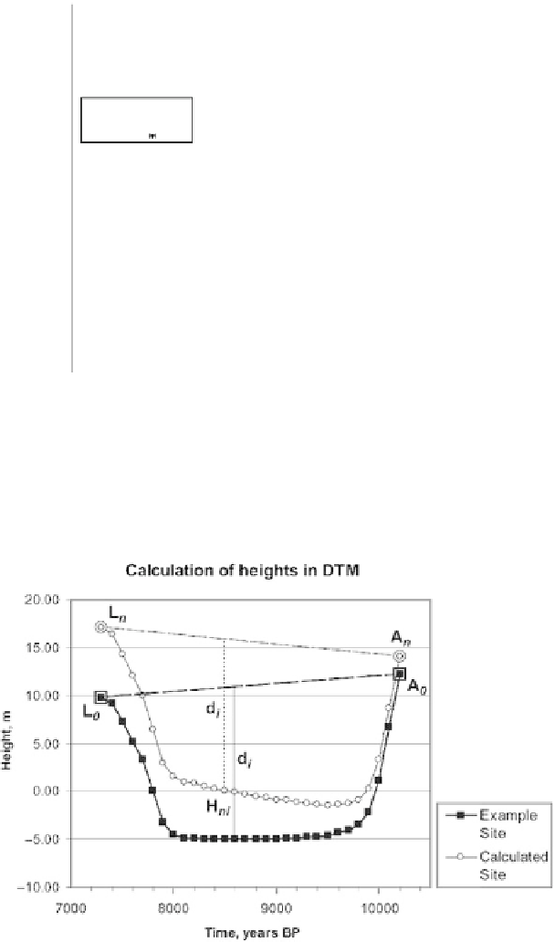
Fig. 8.4
Principle scheme for calculation of water-level change for any new grid cell