Geoscience Reference
In-Depth Information
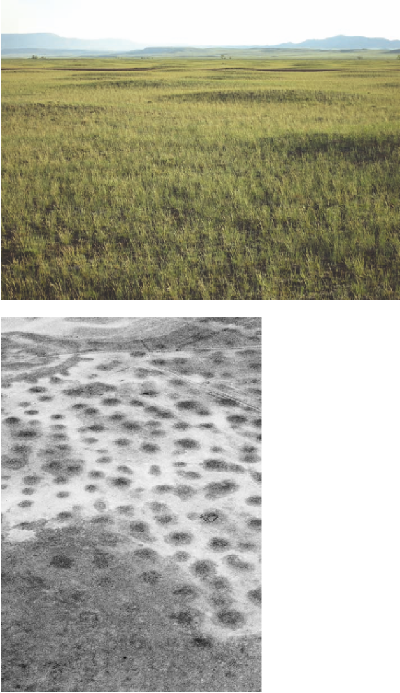
Fig. 9.9. (above) Mima mounds in the Laramie Basin. the veg-
etation is high-elevation mixed-grass prairie, dominated by
junegrass, Sandberg bluegrass, indian ricegrass, needle-and-
thread grass, blue grama, fringed sagewort, and Hood's phlox.
Fig. 9.10. (left) Aerial view of mima mounds in the Laramie
Basin. in this area the mounds are partially on the broad
floodplain of the Big Laramie River (see chapter 17). elevation
7, 2 5 0 f e e t .
a stabilizing tree or tall shrub, with the soil in between
more susceptible to erosion. After the trees or shrubs
died, the mound persisted, though possibly with some
smoothing by wind. indeed, the mound distribution
patterns are often similar to tree distribution patterns
in woodlands and savannas, but there is little or no sup-
porting evidence for this explanation.
the frost hypothesis has received more attention than
the deposition and erosion hypotheses in Wyoming.
From the air, the mound pattern gives the impression of
sorted polygons that are common in the arctic tundra
(see fig. 9.10), an observation that suggests the mounds
were formed about 20,000 years ago when there were
glaciers in the mountains and the climate was colder.
indeed, Wyoming intermountain basins at that time had
environments, soil cracks 3 feet deep or more were cre-
Search WWH ::

Custom Search