Geoscience Reference
In-Depth Information
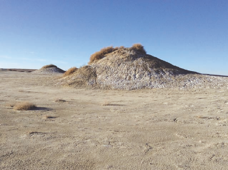
Fig. 9.8. Mud springs in the chain
Lakes area, located in the lowest part
of the Great Divide Basin, are currently
dormant. Plants include greasewood
and shadscale. A playa with little or
no vegetation surrounds the conical
mounds. elevation 6,500 feet.
ever, it is possible that the mounds are rejuvenated by
periodic rather than continuous “eruptions.” Hayden
observed deep pools of muddy water in the area near
the mounds, covered by a thick layer of crusty silt that
gave the appearance of solid ground. He wrote, “innu-
merable bones of animals, who here sought to quench
their thirst, provide the treacherous character of the
soil.” A nearby pond was christened “Death Lake” by
the explorers.
Mima mounds raise two questions: What is the
effect of the mounds on plant and animal distribu-
tion, and how did they originate? the effect on plants
can be subtle, with no obvious differences between
mound and intermound vegetation. elsewhere, the
vegetation on the mounds is taller or composed of
different species. For example, the mounds may have
more big sagebrush and higher plant growth rates than
that burrowing mammals, such as pocket gophers and
ground squirrels, are more common on the mounds.
through their burrowing, the mammals create soils
that have a reduced bulk density (weight per unit vol-
ume), enhanced infiltration rate, and improved nutri-
ent availability. Vegetation differences can be expected
when mound and intermound soils are different, but
whether the differences are due to the soil or associated
animals is still unknown. Unfortunately, cheatgrass
has been found on the tops of some mima mounds in
the Laramie Basin.
23
the more perplexing question about mima mounds
pertains to their origin. there are various hypotheses
that involve wind deposition (coppice dunes), erosion,
frost heaving, groundwater flows, burrowing animals,
and even seismic activity. the erosion hypothesis sug-
gests that the tops of mounds were once the location of
Mima Mounds
A peculiar feature of some lowland grasslands and
shrublands in Wyoming are hundreds of closely spaced
mounds that are 12-24 feet in diameter and usually less
than 2 feet high (figs. 9.9 and 9.10). they are common on
the east slope of the Laramie Mountains (west of chey-
enne), in the Laramie Basin southwest of Laramie, and
in the Shirley Basin north of Medicine Bow (all at low
elevations). equally puzzling mounds occur in numerous
other places in north America and in Argentina, Kenya,
mounds, and biscuit land, they are most commonly
referred to as mima or mima-like mounds, because they
were first described on the Mima Prairie in western
Washington.
Search WWH ::

Custom Search