Geoscience Reference
In-Depth Information
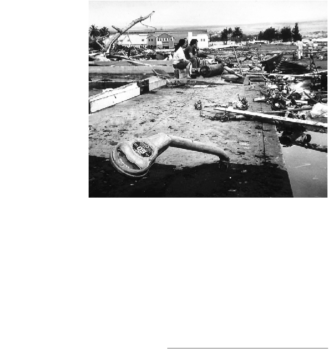
Fig. 6.8
Aftermath of the May
22, 1960 Chilean Tsunami in the
Waiakea area of Hilo, Hawaii,
10,000 km from the source area.
The force of the debris-filled
waves bent parking meters.
Photograph credit U.S. Navy.
Source National Geophysical
Data Center,
http://www.ngdc.
was so big that it was considered that the next event would
not occur within this timeframe. This anticipated event
occurred 50 years later at 03:34 local time (06:34 UTC), on
February 27, 2010 with a M
w
8.8 magnitude earthquake
centered at 39.5 S, 74.5 W, 35 km below the seabed
(Fig.
6.5
). It was the sixth strongest earthquake recorded.
Over 500 km of subducting faultline ruptured immediately
north of the segment that ruptured in 1960 (Moreno et al.
2012
). It is a classic example of an earthquake filling
adjacent seismic gaps that had not moved since 1835 and
1928. Because two segments ruptured, one would expect
not only a large earthquake, but also a big teleseismic tsu-
nami. The expected magnitude of the tsunami did not
eventuate because much of the slippage occurred at depth
and towards land (Lorito et al.
2011
). In fact, the seismic
gaps may not have been closed and may still have the
potential to generate a large teleseismic tsunami. These
characteristics, which were only defined with precision
afterwards, resulted in a large tsunami locally, but none of
significance in the wider Pacific Ocean. At the time, the size
and location of the earthquake triggered an immediate
warning for a significant Pacific-wide tsunami. The closest
DART buoy, located 1170 southwest of Lima, Peru,
recorded a deep water amplitude of 22 cm that reinforced
this warning (National Data Buoy Center
2013
). Beaches,
harbors and marinas around the Pacific were closed to the
public or evacuated. Thirty minutes after the earthquake
began, a tsunami rolled into the Chilean coastline at
numerous locations with a height up to 2.6 m measured on
tide gauges (Fritz et al.
2011
; National Geophysical Data
Center
2013
). A maximum run-up of 29 m was recorded at
Constitucion, Chile. Eighty-seven locations in Chile recor-
ded run-ups greater than 10 m, of which ten reported run-
ups in excess of 20 m. The death toll in Chile was 525
people with 25 missing. The energy of the tsunami was
directed northwards into the Pacific Ocean, focusing on
Japan, Hawaii and southern California where tide gauges
registered maximum heights of 0.82, 0.98 and 1.2 m
respectively. The greatest height, 1.79 m, was registered at
Hiva Oa Island, French Polynesia. As a teleseismic tsunami
event across the Pacific Ocean, the February 27, 2010
earthquake was surprisingly of little significance.
6.4
Alaska, March 27, 1964
The Alaskan earthquake struck on Good Friday, March 27,
1964 at 5:36 PM Alaska Standard Time (03:26 UTC, March
28, 1964) along a seismically active zone paralleling the
Aleutian Islands (Fig.
6.9
a) (Van Dorn
1964
; Hansen
1965
).
The area is noted for large tsunamigenic earthquakes that
have had a continuing impact upon the Pacific Ocean
recorded history occurred on January 20, 1878, April 1,