Environmental Engineering Reference
In-Depth Information
1.4
Existing Conditions
1.2
Relocating the river entrance to 5.5 km south of St Louis
1
Creation of an Emergency Flood Breakthrough Entrance
0.8
Reducing peak discharge from the Diama Barrage
0.6
0.4
0.2
0
-0.2
-0.4
23-06-2000
12-08-2000
01-10-2000
20-11-2000
09-01-2001
28-02-2001
19-04-2001
08-06-2001
28-07-2001
Fig. 4
Evolution of water levels in St. Louis under different scenarios of management of the Senegal River estuary (Source DHI 2002)
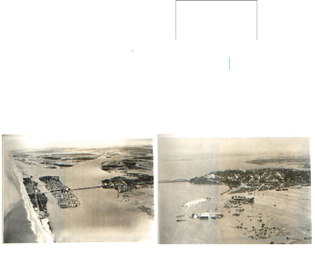
Photo 1
Aerial views of St. Louis suburb of Sor and during the 1950 flood (Courtesy to NDIAYE Gora)
of more or less 90 mm is recorded (Kane
2010
). River
floods are related to the low topography of St. Louis Island
which was flooded when the water level reached
1.5 m IGN; the ordinary high watermark of the river is
1.2 m IGN. As a result of hydraulic installations such as the
jetty and rehabilitation of the docks, these values have been
revised upwards. The alarm level is now set at 1.75 m for
St. Louis while the peripheral districts such as Diaminar,
Pikine
recently, several flood events were noted in the lower
estuary with water levels higher than 1.80 m IGN. In 1999,
a record height of 2.10 m IGN was reached in October,
followed by particularly severe flooding, probably less
severe than in 1950 (Photo
1
) but more severe in relation to
the spatial extension of the city.
In 2003, heavy rainfall in the upper basin resulted in the
arrival of five successive flood waves at the Bakel station
between August and October 2003. These affected the
valley and the estuary which recorded early and significant
water levels, generally above alarm levels. The alert level in
St. Louis is 1.50 m IGN, a height reached on 19 August
2003. In mid-September, the water level has always been
between 1 and 1.50 m in St. Louis and between 1.35 and
1.60 in Diama. The dam discharged more than
1,000 m
3
s
-1
over a period of more than two months. The
rising waters become alarming for St. Louis; the managers
and
Khor
are
under
threat
from
a
level
of
1.20 m IGN (Fig.
4
).
Since the nineteenth century, the city of St. Louis has
experienced floods, more or less severe depending on the
quality of the interventions by the local authorities and/or
management of the Senegal River Basin. Kane (
1997
)
recorded more than ten exceptional floods between 1850
and 1950, all of which resulted in severe flooding of the city
and its surroundings, in particular the suburb of Sor. More


Search WWH ::

Custom Search