Geoscience Reference
In-Depth Information
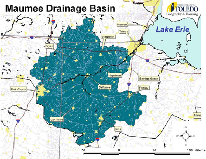
Fig. 8.1 The Maumee Drainage Basin, NW Ohio
Lake Erie south of the Ohio-Michigan state line. The cities of Toledo, Fort Wayne,
and Lima constitute the major urban areas. Other smaller towns and cities are
scattered throughout. The population of this area totals over 1.2 million people.
Land use is predominantly agriculture covering about 71% of the total basin
(NRCS
2005
). Urban development and roads represent 10% of the area (NRCS
2005
). Soils are naturally poorly drained. Surface ditches and subsurface drains
have been implemented to improve drainage. The basin area receives a relatively
even distribution of precipitation throughout the year between 33 and 37 in. depen-
ding on the location. Soil erosion is a major problem in the basin causing NRCS
to track conservation tillage practices in order to reduce the loss of sediment off
cropland. Dredging in the Toledo Harbor, at the mouth of the Maumee River, is
costing $2.2 million per year due to sediment loading. Tourism and sport fishing
are also directly related to water quality and the health of the lake associated with
increased sedimentation (NRCS
2005
). Several watershed planning efforts have
been undertaken with the Maumee Basin, especially in the Maumee Great Lakes
Area of Concern (AOC) located in the lower (downstream) portion of the Maumee
River and including several other rivers and streams discharging directly into the
western basin of Lake Erie (Lawrence
2003
; Maumee RAP
2006
).