Geography Reference
In-Depth Information
Figure 12.3: GRASS edit tools in QGIS
will be disabled. Now that everything is in order, we can click the
Edit
the following page.
Which layer are we editing? The answer is the one highlighted in the
legend when you bring up the edit tools. Fortunately, if the highlighted
layer isn't a GRASS vector map, the
Edit GRASS Vector layer
tool will be
disabled. So, the trick is to make sure the layer you want to edit is
highlighted before opening the edit tools.
The edit tools closely mirror those used when digitizing in GRASS, a
First we will look at the basics of the editing tools and then get into the
specifics. The task we'll use to illustrate simple editing is adding a new
city to the world. Since our mapset is already open, we can load the
cities
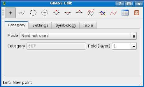
layer and use it for our editing task. Each feature in GRASS has
a category field named
cat
that serves as the identifier. When we add
a new point (city), we have a choice of how that category is created, as
shown in the Mode drop-down box. The choices are as follows:
• Next Not Used: The next unused category will be assigned auto-
matically.
• Manual Entry: You will enter the category manually when you cre-
ate the feature.
• No Category: No category will be assigned to the new feature.


Search WWH ::

Custom Search