Geoscience Reference
In-Depth Information
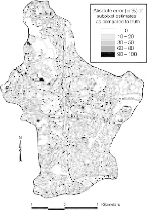
Figure 19.3
An error grid showing the absolute per-pixel error between the truth and subpixel estimates.
measurement of accuracy, derived from the contingency table, is very low. Furthermore, the
assessment of accuracy of subpixel estimates over large areas using a sampling scheme based on
sampled unit areas (i.e., 5
9 windows) may not be as accurate as one based on the simple
random sampling of individual pixels to derive a whole-area estimation of an MOI. For applications
over large geographic regions, high-resolution, multispectral satellite data could provide an optimal
data source for these sampling situations. Further investigation is necessary to corroborate these
results over multiple watershed areas using more accurate reference data.
The spatial and statistical techniques reported here provide an analytical tool that can be used
to make per-pixel, unit-area, or correlation-based accuracy assessments of subpixel derived classi-
fication estimates easily. In addition, these techniques allow the spatial relationship of the per-pixel
error to be explored. The raster overlay technique easily extracted the data necessary to derive these
assessments. The ArcView Avenue format script used here, although primarily suited for the
assessment of data at the subpixel level, can be utilized (or altered) to derive the accuracy of any
classified data set in which higher-resolution truth data are available.
¥
5 or 9
¥
19.5 SUMMARY
This chapter presents a technique for assessing the accuracy of subpixel derived estimates of
impervious surface extracted from Landsat TM imagery. We utilized spatially coincident subpixel