Global Positioning System Reference
In-Depth Information
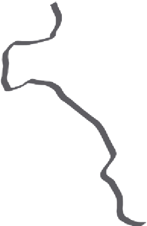
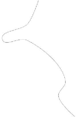
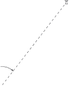
FIGURE 7.1.
Estimating distance off. By measuring bearing angles
a
and
b
to a
prominent reference point onshore—here, a coastal beacon—and then estimating
the distance,
D
, covered by his ship between the two measurements, a navigator
can estimate
R
, his distance off.
''distance o√''—the distance of a ship from the shore. There is a stark
contrast between these processes and the rough-and-ready methods of
earlier times.
Consider the ship of figure 7.1. (Let us imagine it to be an eighteenth-
century French bark, exploring the Pacific Islands.)
2
With his chip log and
pocket watch, the navigator can measure the distance,
D
, that his vessel
covers between two angular measurements. These angles,
a
and then
b
,
obtained with a sextant, are between the ship's heading direction and a
prominent coastal feature, in this case a beacon. From the geometry our
navigator can calculate
R
, the distance o√. For example, if he determines
that angle
a
is 40\ and
b
is 90\, and that the distance
D
between the two
measurements is 2.00 km, then he finds that
R
is 1.68 km.
2. During this period the French ''discovered'' many of the 20,000-30,000 Pacific
Islands, as free-roaming captains such as de Bougainville planted the French flag on any
remote speck of land in this vast ocean. Their great rivals of the age, the British, did
likewise, of course. Earlier, the Spanish had been at the fore of Pacific exploration, with
three expeditions from South America that reached as far as the Solomon Islands, o√ the
east coast of New Guinea, and the New Hebrides.