Geology Reference
In-Depth Information
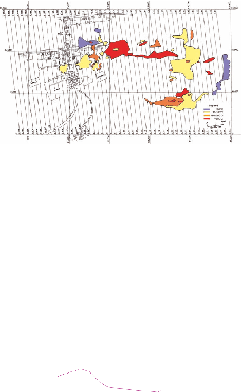
Figure 16.4.9. Temperature zones as inferred from subsurface temperature measurements in Centralia,
Pennsylvania. The east to west distance is 5000 ft (1525 m) or ~1 mile (1.6 km). The south to north distance is
~3000 ft (915 m). The maximum temperature (darkest area) is >600°F (>315°C). From Chaiken et al. 1983, p. 76.
lines L1, L2, L3) by 10m (north
south) with intersections at 5m intervals, was used for data points. The long side
of a measurement grid was placed more or less parallel to the southern slope of the waste pile. Temperature data
were obtained at 43 vertical thermocouple (TC) wells placed at 5 m spacing over the northern area. The wells
extended from the surface to between 3 and 6m depths. Temperatures were taken every 0.3m in the wells.
Additional TC wells were inserted into the pile from the slope. The initial temperature surveys indicated that there
were two areas of combustion. The fire zone in the western portion of the site was smaller and was apparently
cooling. A more extensive combustion zone was located in the eastern portion of the site. Hot spots, marked by the
emission of water vapor and sulfurous fumes, were located on the southern slope and extended into the bank.
-
The maximum temperatures in the heated areas were detected at the depths between 2.7 and 2.8m, indicating that
combustion was occurring near the waste/clay interface. A temperature surface for the eastern zone indicates the
Study
site
Highwall
OHIO
Tipple
West
combustion
zone
N
East
combustion
zone
0
10
20 ft
Elevation
CI=0.6m
(2 ft)
3
0
6m
Temperature
probe
Scale
Injection
probe
Seismic
line
Figure 16.4.10. Map of Midvale waste bank with topographic contours, location of remains of old tipple,
temperature wells, and injection probes. From Cohen and Dalverny 1995, p. 71.