Geology Reference
In-Depth Information
CHAPTER 14
u
u
Remote Sensing of Coal Fires
CHAPTER CONTENTS
14.1 Remote Sensing
Introduction
14.2 Principles of Remote
Sensing
Electromagnetic Energy
and Spectrum
Visible and Near-Infrared
Regions
Shortwave and Thermal
Infrared Regions
Microwave Region
14.3 Remote Sensing Platforms
and Sensors
Overview and
Significance
14.4 Coal-Fire Parameter
Extraction from Remote
Sensing Images
Introduction
Crack-Density Mapping
Reflection-Aureole
Mapping
Land-Cover (Coal Area)
Mapping
Fire-Area Estimation
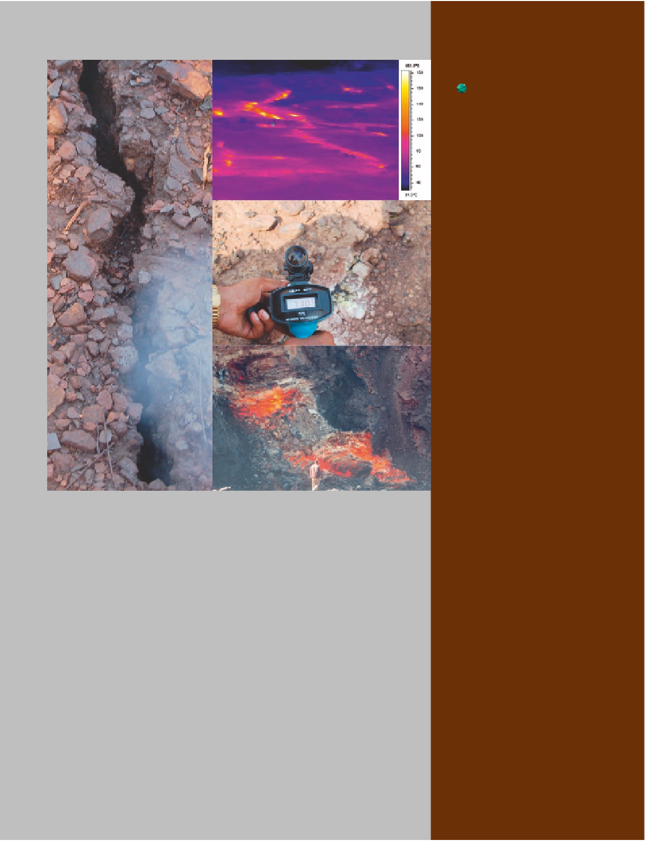
Photo mosaic showing that coal fires are high temperature phenomena that can be
mapped, monitored, and quantitatively characterized by using remote sensing and field
techniques. The ground fissure on the left, in the Jharia coalfield, India, is 2 m long and
15 cm wide. The thermal image on the upper right is an oblique perspective of a 12 m
wide area underlain by an active coal fire in the Jharia coalfield. It was acquired in the
7.5
Fire-Depth Estimation
Subsidence Mapping
Greenhouse-Gas
Emissions
m wavelength range with a forward looking infrared (FLIR) camera. The yellow
to white areas represent relatively higher surface temperatures over ground fissures. The
radiometer in the middle-right photo records a temperature of 710°C several millimeters
above a fissure in the Jharia coalfield where an active, possibly shallow, underground fire
occurs. Note the white by-product of combustion, on the right side of the fissure,
nucleated from coal-fire gas. The photo on the bottom right is of a coal fire in an opencast
mine in the Ruqigou coalfield, China.
-
13
μ
14.5 Time Series Analysis and
Integrated Interpretation in
a GIS
All photos by Anupma Prakash.
Introduction
Important Terms
References
WWW Addresses:
Additional Reading