Geology Reference
In-Depth Information
1.2.1
Structure Contour Map
A structure contour is the trace of a horizontal line on a surface (e.g., on a formation
top or a fault). A structure contour map represents a topographic map of the surface
of a geological horizon (Figs. 1.2, 1.3). The dip direction of the surface is perpendicu-
lar to the contour lines and the dip amount is proportional to the spacing between the
contours. Structure contours provide an effective method for representing the three-
dimensional form of a surface in two dimensions. Structure contours on a faulted
horizon (Fig. 1.3) are truncated at the fault.
1.2.2
Triangulated Irregular Network
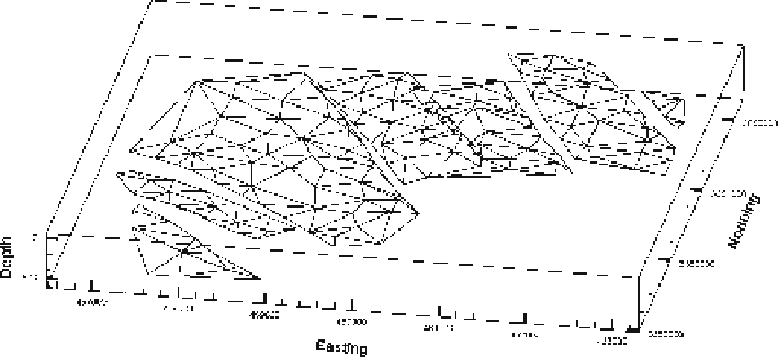
A triangulated irregular network (TIN; Fig. 1.4) is an array of points joined by straight
lines that define a surface. In a TIN network, the nearest-neighbor points are connected
to form triangles that form the surface (Banks 1991; Jones and Nelson 1992). If the
triangles in the network are shaded, the three-dimensional character of the surface
can be illustrated. This is an effective method for the rendering of surfaces by com-
puter. The TIN can be contoured to make a structure contour map.
1.2.3
Cross Section
Even though a structure contour map or TIN represents the geometry of a surface in
three dimensions, it is only two-dimensional because it has no thickness. To completely
represent a structure in three dimensions, the relationship between different horizons
must be illustrated. A cross section of the geometry that would be seen on the face of
a slice through the volume is the simplest representation of the relationship between
Fig. 1.4.
Triangulated irregular network (TIN) of points used to form the upper map horizon in Figs. 1.1 and
1.3. 3-D perspective view to the NW, 3
×
vertical exaggeration. Vertical scale in ft, horizontal scale in meters