Geoscience Reference
In-Depth Information
Figure 2.9
Observed and predicted discharges for the Kings Creek, Kansas (11.7 km
2
) using the VIC-2L model
(see Box 2.2); note the difficulty of simulating the wetting up period after the dry summer (after Liang et al.
1996, with kind permission of Elsevier).
ESMA-typemodels are also still used for representingGIS-derived hydrological response units.Models
of this type include the group response units WATFLOOD model (Cranmer
et al.
, 2001); the PMRS
(Leavesley and Stannard, 1995); the USDA-ARS SWAT model of Arnold
et al.
(1998); the Arc Hydro
modelling systemofMaidment (2002) and the recent model of Vinogradov
et al.
(2011).We run into a few
model classification problems here: such models aim to represent hydrological processes in a distributed
manner, but using functional components in the style of ESMA models at the scale of the GIS-derived
HRU, rather than attempting full process descriptions. It is a modelling technology that has been driven
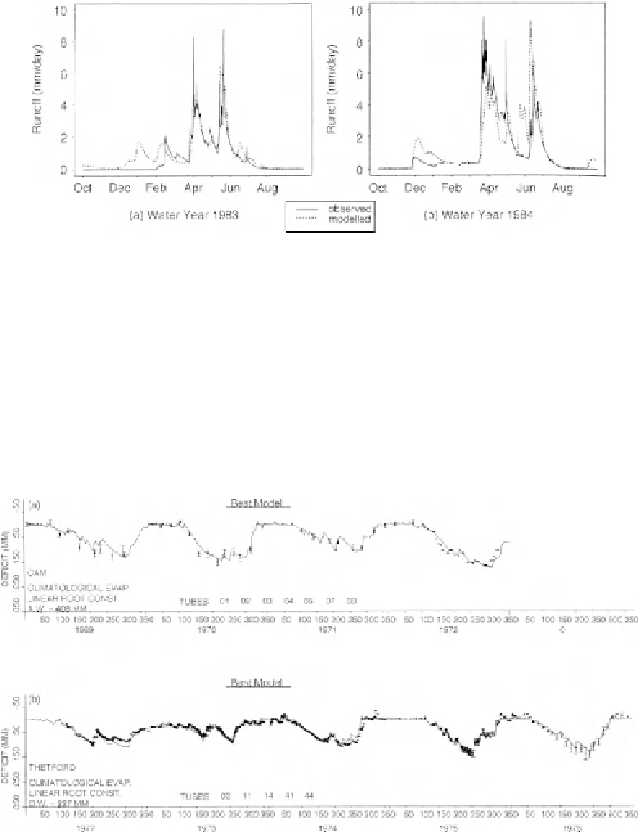
Figure 2.10
Results from the prediction of soil moisture deficit by Calder et al. (1983) for sites in the UK:
(a) the River Cam and (b) Thetford Forest; observed soil moisture deficits are obtained by integrating over
profiles of soil moisture measured by neutron probe; input potential evapotranspiration was a simple daily
climatological mean time series (with kind permission of Elsevier).