Geography Reference
In-Depth Information
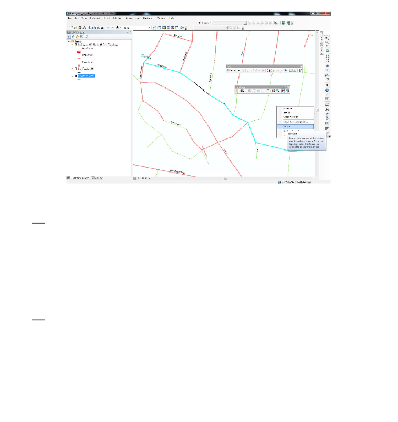
FIGURE 9-15
17.
Erase parts of Strawberry:
Bring up the Editor toolbar and the Topology toolbar. Start Editing
and then make the Fix Topology Error tool active on the Topology toolbar. Click on a portion
of Strawberry that is overlapped by the pink topology line. It will turn black. See Figure 9-15.
Right-click, then click Subtract. In the Subtract window, pick Lex_Roads_2002. Click OK. Both
the feature and the topology disappear. Erase a few more road segments in the area, by
“subtracting” the segments that are overlaid with the “topology error” lines. Click the 1994
roads on and off to demonstrate to yourself that the roads are really gone from the 2002 roads.
(Leave the 1994 Roads turned off.) So, we have a technique for erasing roads that existed in
both datasets — which would ultimately leave us with our goal: those roads built since 1994.
However, this would be a long process for the thousands of segments in the city. How could we
do it differently?
18.
One possibility for erasing all the Lex_Roads_2002 identified by topology would seem to be
to select a large number of them at once. Drag a large box that encompasses several of the
features identified by the topology. They will turn black. Now right-click. Unfortunately, the
Subtract option doesn't exist when you right-click. If you check the Help files, you will discover
that multiple subtracts are not implemented. Turn off the labels of Lex_Roads_2002. Stop
editing without saving edits.
We certainly don't want to go through Lex_Roads_2002 subtracting segment by segment. Let's
try another approach: Buffering the Lex_Roads_1994 (which have been snapped to the Lex_
Roads_2002 where both exist) and then erasing, with an analysis tool, those Lex_Roads_2002
that lie within the buffer.


Search WWH ::

Custom Search