Geography Reference
In-Depth Information
8.
In ArcToolbox go to Conversion Tools > To Raster > Feature to Raster and run the tool. Select
Soils from the drop-down menu. For Field, pick SUIT. If the Output cell size is not 10, make it
10. For the Output raster, browse to
___IGIS-Arc_
YourInitials
\Spatial_Analyst_Data\WC_Boat_SA\Wildcat_Boat_SA.mdb
For the name type Soils_rr10m (rr being our designation for raster resolution; 10m meaning
10 meters). Click Save. Check the Feature to Raster window and click OK if all the boxes say
what they should. The status bar will show the progress and a popup window will tell you when
the process is done.
Creating a raster in this way will put a raster dataset in the folder you specified and also add a layer
to your map. By clicking List By Source in the T/C you can note that the raster dataset goes into the
personal geodatabase Wildcat_Boat_SA.mdb.
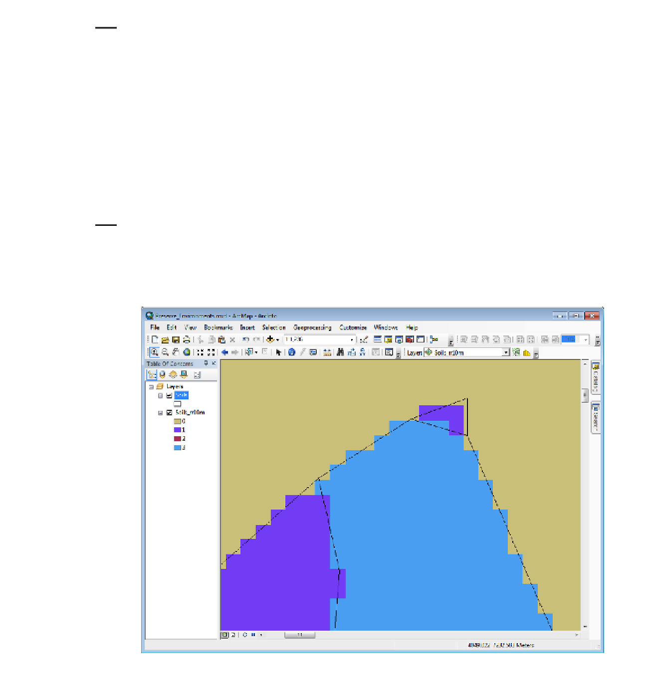
9.
Go back to List By Drawing Order and, if Soils isn't already the topmost layer, make it so. The
raster layer Soils_rr10m should be just below it. Make the Soils layer Hollow or No Color, so you
can see both the raster, and also the polygon boundaries. Zoom in on the northernmost point of
land in the northwest quadrant of the map. See Figure 8-40.
FIGURE 8-40


Search WWH ::

Custom Search