Geology Reference
In-Depth Information
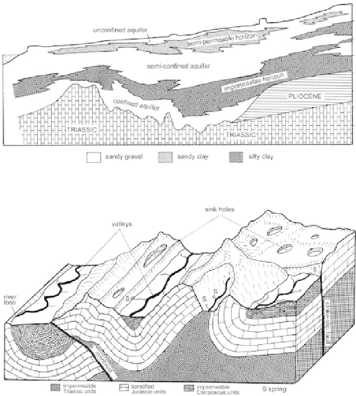
deposits. This is the case in Figure 61, which provides a general visual
representation of the extent of the three distinct alluvial aquifers below the
city of Nice, in sandy gravel interlayered with an impermeable clay-mud
horizon and a discontinuous, semi-permeable sandy silt level.
Finally, the creation of block diagrams can facilitate the spatial
visualization of major structural diffi culties, and illustrate the importance
and the limits of remaining unknowns. Figure 62, for example, presents the
tectonic style of the subalpine Castellane range, in the highlands behind
Grasse (Alpes-Maritimes), which is marked by E-W fold and thrusts. The
Figure 61
Geometry and extent of the alluvial reservoirs in the Paillon in Nice (Alpes-Maritimes)
(from Pline, 1991).
Figure 62
Representation of the tectonic style in the subalpine Castellane range, in the
highlands behind Grasse (Alpes-Maritimes).
Search WWH ::

Custom Search