Geography Reference
In-Depth Information
The resulting raster image was then clipped to the shape and size of the study
area (Figure 6a) with the ‗extract by mask' tool of the spatial analyst tool box
of the GIS software.
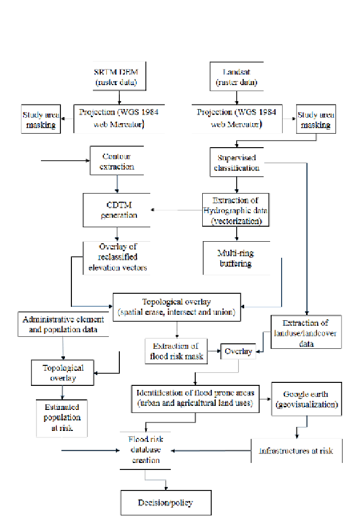
Figure 5. Methodological framework of GIS-based flood risk modeling.