Environmental Engineering Reference
In-Depth Information
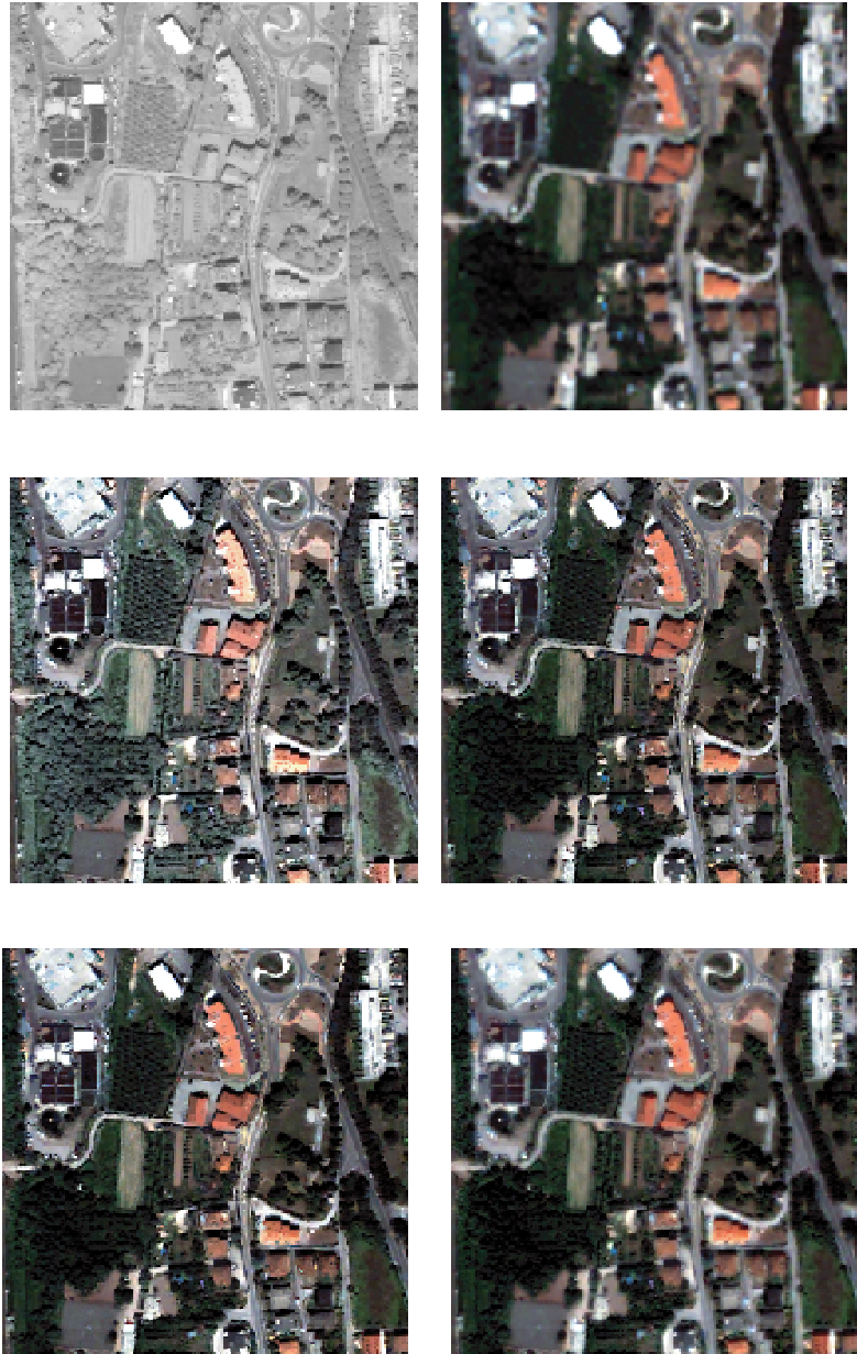
The Pan detail relative to the QuickBird image is reported
in Fig. 10.4(a) and constitutes the visual reference for spatial
quality. The expanded MS is shown in Fig. 10.4(b) and repre-
sents the reference for spectral, i.e., color, quality. Figure 10.4(c)
portrays the GS pan-sharpened image obtained by ENVI. Spa-
tial enhancement is apparent when comparing this result with
Fig. 10.4(b); some spectral distortions can be noticed on roofs,
whose red color is too bright, and on vegetated areas that appear
too light when compared to the correspondent MS areas. Indeed,
notwithstanding that visualization parameters have been set in
thesamewayforalltheimages,theGSfusedimageexhibitsan
apparent change in colors with respect to all the other images.
Figure 10.4(d) shows the GLP-CA fused image. Both spectral
and spatial quality is high; details appear sharp and accurate.
(a) Pan image
(b) Expanded MS Image
(c) Gram-Schmidt
(d) GLP-CA
(e) GSA-CA
(f) GMMSE
FIGURE 10.4
Detail of the QuickBird test area (512 × 512) processed by the selected Pan-sharpening algorithms. The
original Pan (a) and expanded MS (b) images are reported in order to give a reference. Spatial enhancement is noticeable
for all the fused images. Spectral distortion of GS algorithm (c) is apparent while all other algorithms show colors very similar
to the expanded MS.


Search WWH ::

Custom Search