Geoscience Reference
In-Depth Information
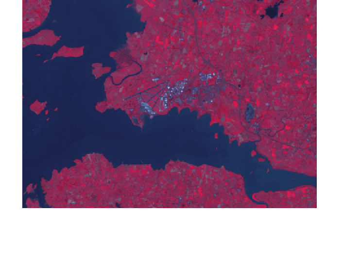
Fig. 13.5
Subset of IRS LISS-III scene (Shannon Airport, Co. Clare, Ireland)
otbcli_Segmentation -in subset.tif -filter meanshift -mode
→
raster -mode.raster.out meanshift_segmentation.tif uint16
For the purposes of the example, we will perform a segmentation on a subset of
a LISS-III scene from the IRS satellite that covers part of County Clare in the south
west of Ireland and includes Shannon airport (Fig.
13.5
).
The following figures present the output of the segmentation algorithm based on
theMean Shift algorithm (Fig.
13.6
) and the Edison algorithm (Fig.
13.7
). The images
on the left present the output based on the default command line specification where
only the algorithm type is specified, while the images on the right present the output
where the minimum size of the segments is defined, in this case 50 pixels. Although
at this zoom it is difficult to determine the impact of this change, Table
13.1
details
the resulting differences based on the number of segments produced by the different
methods. Figure
13.8
presents the difference of the two algorithms for a subset of the
image located over Shannon airport.
The full command line used to calculate the segmentations is defined as follows:
otbcli_Segmentation -in subset.tif -filter meanshift
→
-filter.meanshift.minsize 50
-mode vector
→
-mode.vector.out segmentation.sqlite


Search WWH ::

Custom Search