Geography Reference
In-Depth Information
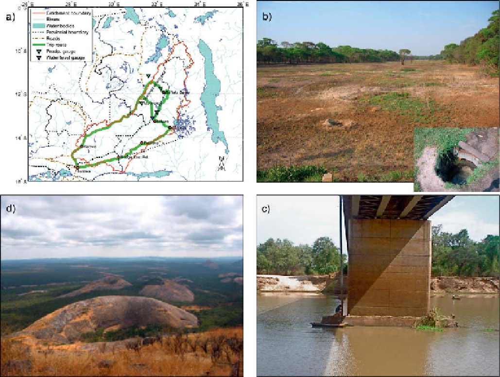
Figure 11.56. An impression of the Luangwa Basin within the Zambezi catchment. Clockwise we see (a) a map of the Zambezi catchment with
Lake Kariba and Lake Cahora Bassa and the Luangwa Basin; (b) a typical
'
dambo
'
wetland with an inset scoop hole; (c) the gauge that we
installed at the Mfuwe bridge; and (d) the typical landscape of the Luangwa Basin.
the fact that large parts of the catchments are ungauged
and that floods generated in these catchments can poten-
tially damage these dams if discharges are not well antici-
pated. The Luangwa is a major Zambian tributary to the
Zambezi, which joins the main river in between these two
major dams. If floods are expected, then the Cahora Bassa
dam needs to start spilling enough water to provide flood
storage. If the operators spill too much, they may cause
unnecessary harm downstream and lose valuable power
generation potential; if they spill too little, they may
damage the dam or even put the dam in danger of being
destroyed. Operational flow prediction in the Luangwa is
therefore very important. This makes the operators in
Mozambique completely dependent on forecasts from
Zambia, which has no gauging in place.
To develop an operational real-time flow prediction model
in an ungauged basin, the opportunity is taken to make use of
any hydrological information that may be available under
such ungauged conditions (see
Chapter 3
). This can be done
by effectively combining the information, both to constrain
hydrological model parameters and to enhance model struc-
ture (Seibert and McDonnell,
2002
;Winsemiuset al.,
2006
,
2008
;Kleeset al.,
2007
; Yadav et al.,
2007
;
Fenicia et al.,
2008a
). For information to be used during calibration, multi-
objective calibration techniques have been proposed (Vrugt
et al.,
2003
), but in our case study (and many other potential
case studies in the world) such calibration techniques are not
applicable. In fact, a typical problem of many ungauged or
scarcely gauged river basins in the world is that even when
there are some ground data available, these may be sparse,
inaccurate, intermittent, non-concomitant and collected at
different time scales, hence it is not clear how one can
integrate their non-conventional information content for use
in predictions.
Search WWH ::

Custom Search