Geography Reference
In-Depth Information
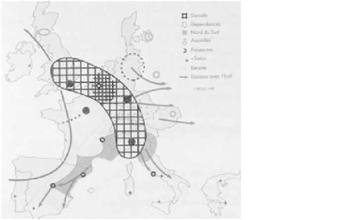
Figure 1.1
'Dorsale Européenne' or the 'Blue Banana'
Source: Reclus (1989); reproduced in VROM, 2000: 25
raising awareness and understanding about complex spatial development trends at
European level. The 'Blue Banana' identifies a highly developed area stretching
from the south-east of England to the north of Italy. The 'Blue Banana' has often
been criticised for the rather simplistic representation of core and periphery in
Europe. Nevertheless, this powerful image has become central to transnational and
national planning discourses, and has prompted an increasing number of altern-
ative spatial conceptualisations of the European territory, such as the 'European
Bunch of Grapes' (see Figure 1.2), which, rather than conceptualising economic
realities, present a desirable (or normative) future for Europe by visualising a poly-
centric structure of competitive urban agglomerations instead of one economic
core region (Kunzmann and Wegener, 1991).
The need for collaboration amongst countries and regions because of the
increasingly transboundary nature of urban and regional development, and the
growing interdependence of nations, is promoted by both the European Union
and the Council of Europe. Transboundary collaboration, consequently, has
steadily expanded at the European, multilateral and bilateral levels since the
beginning of the 1990s. Cartographic illustrations are a central communication
medium for the planning discipline, and their potential role in transnational
spatial planning processes outside a formal legal competence and established
planning discipline is unquestionable. In transnational planning processes, the
use of cartographic representations can help to frame spatial policies (Faludi,