Geology Reference
In-Depth Information
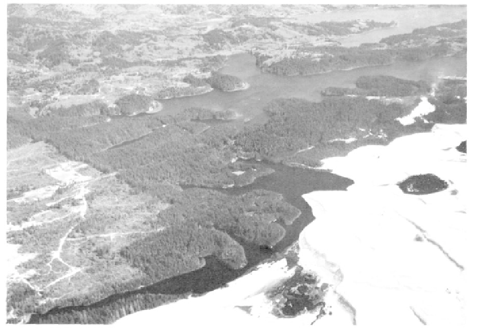
Ever-changing sand dunes, sheltered lakes, and dense forests come together along the southern
Oregon coast. Lake Cleawox is in the foreground, Woahink is in the upper center, and a portion of
Siltcoos Lake is at the upper right (photo Oregon State Highway Department).
was originally, and only a small volume of alluvium
would be necessary to fill it.
Loon Lake in southwestern Douglas County
has a similar history. Great blocks of Tyee sandstone
that slid from the west wall of the valley lie as a
jumbled mass to dam a creek. The creek, also named
Lake Creek, is working on the fill, not on the adjacent
bedrock, but such massive blocks are resistant to
erosion. Loon Lake also was originally a much longer
lake extending several miles upstream from the town of
Ash. Tree trunks standing on the floor of Loon Lake
were drowned at the time of damming approximately
1400 years ago. Ancient Lake Sitkum is a name applied
to the lake that once occupied Brewster Valley at
Sitkum in eastern Coos County. The history of this
alluvial valley is almost identical to that of Loon Lake.
Sandstone slipped northward in the valley to dam the
river. A beautiful lake undoubtedly occupied this
steep-walled valley at one time, but sediment has filled
in the depression.
These lakes are relatively large. Numerous
smaller lakes of similar origin have had an ephemeral
existence in many of the stream valleys where the
landslide material was either less extensive or the
stream was large enough to cut through, draining the
precipitation have combined to form landslide lakes.
Where the strata involved is soft, numerous landslides
occur as the hillside moves more or less continuously
in waves of viscous debris. Saturation during rainy
periods increases the weight of the material. Landslides
are easily recognized by their hummocky surface, tilted
trees, small ponds, and swampy depressions.
During the Pleistocene, some of the massive
sandstone formations, in particular the Tyee and
Flournoy which are susceptible to landslides, moved as
large blocks to dam creeks and form lakes. Such was
the case in the formation of Triangle Lake near
Blachly, Loon Lake near Scottsburg, and perhaps for
the filled lake basin at Sitkum. Triangle Lake in Lane
County was darned by a tilted mass of Flournoy sand-
stone that slid from high on the north slope of the
valley to block Lake Creek. The creek eventually found
an outlet against the south wall where it is incised in
the bedrock rather than in the slide material. This
condition will insure the long life of the alluvial valley
but not necessarily of Triangle Lake which is only the
remnant of a former larger body of water that extended
upstream beyond Horton. Today most of the old lake
has been filled in by alluvium. Triangle Lake is report-
edly 97 feet at its deepest, but this is much less than it