Travel Reference
In-Depth Information
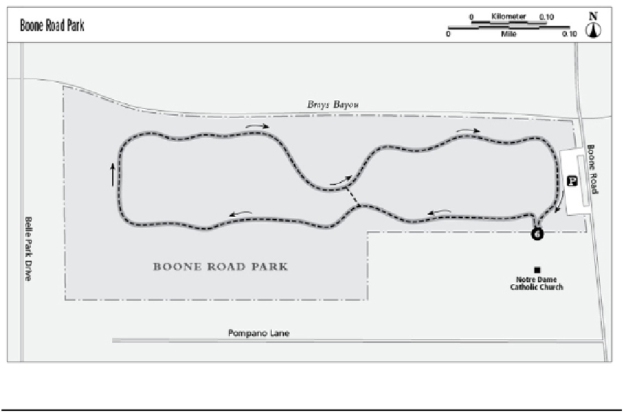
Miles and Directions
0.0
Start at the trailhead adjacent to the paved parking area. Take the trail on the left (west)
side.
0.2
Follow the asphalt trail, heading straight (west) and reach a Y junction. Take the left
branch continuing west.
0.3
The trail bends a little to the left and right; continue straight (west) near the park fence.
0.4
Cross over a culvert and then make a hard right, heading north. Power lines are on the
left.
0.5
Continue straight (north) until the trail makes a hard right (east). Follow the trail east, with
Brays Bayou and residences on left side and the playground and cricket field on the right.
0.6
Follow the trail east as it wanders a little to the right and left.
0.7
Follow the trail as it bends right (east) and pass a DESIGNATED NATURAL AREA sign
on the left (north). The area is partially fenced and is being reforested.
0.8
Continue straight, going east until you reaching a Y junction. Take the left (north) branch.
(FYI: The right branch connects to the south side of the loop.)
0.9
Pass a sidewalk on the right (south) that leads to two volleyball/badminton courts on the
right. Continue following the trail east.