Geography Reference
In-Depth Information
17.2.2.4
Spatial Raster Data
Spatial framework is a finite grid imposed on the underlying space (Worboys
and Duckham
2004
), such as the latitude-longitude system, etc. A finite set of
n computable functions or simple fields
f
f
i
,
1
i
n
g
,where
f
i
: Spatial frame-
work
!
Attribute domain (
A
i
), map the spatial framework
F
onto different attribute
domains
A
i
(Shekhar and Chawla
2003
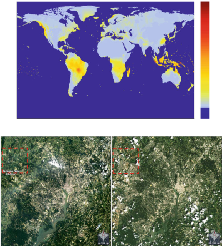
). For example, Fig.
17.4
a shows the global
precipitation distribution represented as spatial raster dataset. The dataset describes
the reanalysis results of rainfall amount all over the world in Jan 1, 1948, where
a
90
9000
8000
7000
45
6000
5000
0
4000
3000
2000
−45
1000
0
−90
0
90E
180E
90W
0
b
Longitude
Fig. 17.4
More examples of spatial data (
a
) Image sequence data (Landsat imagery courtesy of
NASA Goddard Space Flight Center and U.S. Geological Survey) (
b
) A spatial raster dataset from
climate science


Search WWH ::

Custom Search