Geology Reference
In-Depth Information
◗
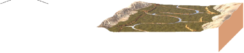
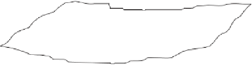
Figure 12.26
Origin of Stream Terraces
Floodplain
Terrace
a
A stream has a broad fl oodplain.
b
The stream erodes downward and establishes a new fl oodplain
at a lower level. Remnants of its old, higher fl oodplain are stream
terraces.
Stream terraces
Floodplain
Terraces
Terraces
Present
floodplain
c
Another level of stream terraces forms as the stream erodes
downward again.
d
Stream terraces along the Madison River in Montana.
Wa t e r fl ows downhill in response to gravity, so the direc-
tion of fl ow in streams and rivers is determined by topo-
graphy. Yet a number of waterways seem, at first glance,
to have defi ed this fundamental control. For instance, the
Delaware, Potomac, and Susquehanna rivers in the east-
ern United States fl ow in valleys that cut directly through
ridges that lie in their paths. These are examples of
super-
posed streams,
all of which once fl owed on a surface at a
higher level, but as they eroded downward, they eroded
into resistant rocks and cut narrow canyons or what geolo-
gists call
water gaps
(
Figure 12.28). The Jefferson River
in Montana was superposed on a ridge that lay in its path
(Figure 12.28c).
A water gap has a stream fl owing through it, but if the
stream is diverted elsewhere, perhaps by stream piracy, the
abandoned gap is then called a
wind gap
. The Cumber-
land Gap in Kentucky is a good example; it was the avenue
through which settlers migrated from Virginia to Kentucky
from 1790 until well into the 1800s. Furthermore, several
water gaps and wind gaps played important strategic roles
during the Civil War (1861-1865).
◗
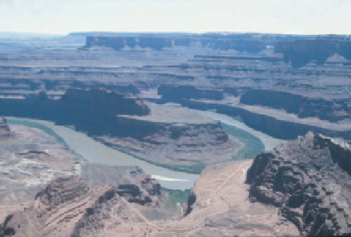
◗
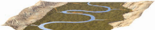
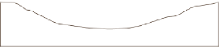
Figure 12.27
Incised Meanders The Colorado River at Dead
Horse State Park in Utah is incised to a depth of 600 m.


Search WWH ::

Custom Search